Traumpfad Hochbermeler
- start: 56729 Bermel, Sports Ground Parking Lot
- destination: 56729 Bermel, Sports Ground Parking Lot
- medium
- 10,45 km
- 3 hours
- 360 m
- 554 m
- 347 m
- 100 / 100
- 40 / 100
The hiking trail leads through wide meadows with spectacular views, quiet valleys with bubbling streams. Experience nature among the juniper and broom heaths.
Highlights on the Traumpfad
- Primeval, quiet nature
- Panoramic views and viewing points far into the Vulkaneifel
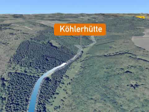
- Historic charcoal burner’s hut
- Circumnavigation of the Hochbermel volcano just below the summit
- Basalt quarry reclaimed by nature
Impressions


General information
Directions
From the parking lot at the Bermel sports ground, a 200m long access path leads to the Traumpfad Hochbermeler, which is best experienced clockwise. After a short section on a wide forest track, the path leads left to the edge of the slope with an impressive view of Bermel. Shortly afterwards, the path allows a detour into the old quarry, where exciting outcrops provide insight into volcanism and earth history.
Afterwards, soft forest paths lead steadily downhill to the outskirts of Fensterseifen. The small village is quickly passed and the Traumpfad soon reaches the forest through flowery meadows. There it ascends to an old mini volcano, the Schälskopf. Now you walk over the open high plateau of the Heunen and enjoy a magnificent view across the Thürelzer Bachtal valley.
The path follows a meadow path to the right, crosses a stream in a small forest and shortly afterwards offers views again over the open fields. Past the Heunenhof, the path descends into the quiet Thürelzer Bachtal valley. It becomes even more dreamy and idyllic after the turnoff at a bridge into the Kimpelbachtal valley. Soon the Hochbermeler turns right into a side valley and winds uphill through primeval mixed forest to the historic charcoal burner’s hut. Along a stream, the Traumpfad follows field and forest paths steadily uphill to the Hochbermel volcano. Its summit is circled just below the peak, opening up unique views into the basalt quarry reclaimed by nature. The path runs near the edge of the former basalt quarry, high up on the Hochbermel. Here unique panoramic views are offered before it goes downhill on a rocky surface back to the junction of the access path to Bermel.
Safety Guidelines
In some sections surefootedness and a head for heights are required.
General safety notice:
Safety instructions - Hiking safely on the Traumpfade
Hikers desire narrow trails, natural paths (across forest floor, grass paths or along streams) and rocky ascents that lead to spectacular views. It is therefore obvious that such paths must be walked with special attention.
What you should pay attention to on your hike:
- Wear weather-appropriate, practical clothing to protect you from cold and wet or heat and sun.
- Plan your hike with appropriate breaks and use your energy sparingly.
- Take sufficient fluids with you. There are not always opportunities to stop along the way.
- Please wear appropriate hiking boots on the Traumpfad, which provide sufficient grip even on slippery and steep or rocky and uneven paths.
- If you think certain sections are not passable for you, you should avoid or turn back. Especially in adverse weather, natural paths can become muddy and slippery.
- In autumn, also pay attention that fallen leaves can cover unevenness, roots, stones or holes in the path.
- Expect impairments of this kind if you go hiking.
- Before your hike, check online at https://www.traumpfade.info/traumpfade/wege-status/ whether the Traumpfad you want to hike might be closed, if there are detours, if path construction work, tree felling or other disturbances are planned.
- Recommended hiking months: April to October.
Difficulty rating
Easy routes
… have only slight changes in elevation and can mostly be completed in half a day in terms of distance. They pose no special requirements on fitness and surefootedness. There are no sections requiring a head for heights. Shorter steeper sections are possible. Depending on the path surface, some parts can be difficult to walk in wet weather.
Medium routes
… can be managed well with normal fitness. Trail-like sections may require good surefootedness, so sturdy footwear is important; hiking poles can be useful. Some slightly longer and steeper ascents and descents are possible. Difficult (at times secured) sections are the absolute exception and can usually be avoided by detours. Natural sections can be difficult to walk in wet weather.
Difficult routes
… require very good fitness and endurance due to length and/or elevation. Very good surefootedness is also necessary to master steep ascents and descents on sometimes demanding paths. Secured sections and/or simple climbing passages requiring a minimum head for heights are possible. Sturdy footwear and hiking poles are important. Paths and exposed sections are often difficult or impossible to pass in wet or wintry weather.
Equipment
Sturdy footwear is recommended for the route!
Trail closures can be found at: https://www.traumpfade.info/traumpfade/wege-status/
Tip
The Hochbermeler can be connected via an access path to the Traumpfad Monrealer Ritterschlag.
Getting there
A 48 exit Laubach - L 99 toward Urmersbach - after 150m turn left onto K 11 toward Eppenberg/Kalenborn – turn right onto L 96 toward Monreal until Bermel - in Bermel turn onto the main street, continue on the ring road until the sports ground
Parking
56729 Bermel, Sports Ground Parking Lot
Public transit
Final stop: Bermel, turnoff
Line 377 Leisure Bus: Mayen - Kürrenberg - Nachtsheim - Boos - Bermel - Monreal - Mayen (April 1 to November 1)
Literature
- Traumpfade & Traumpfädchen volume 2: The 19 best premium circular hikes in the Vordereifel, Ulrike Poller & Wolfgang Todt ISBN: 978-3-934342-61-3
- 27 premium circular Traumpfade routes, Anniversary edition 10 years Traumpfade, Ulrike Poller & Wolfgang Todt, ISBN: 978-3-942779-43-2
Additional Information
Tourist office Vordereifel, Tel.: 02651/800995, tourismus@vordereifel.de, www.naturerlebnis-vordereifel.de
Project office Traumpfade, Tel.: 0261/108419, info@traumpfade.info, www.traumpfade.info
Traumpfade app
Traumpfade app for iOS: Download app on iTunes
Traumpfade app for Android: Download app on Google Play
Weather


This tour is presented by: Traumpfade im Rhein-Mosel-Eifel-Land, Author: Nicole Pfeifer