Traumschleife Dünnbach-Pfad (Dünnbach Trail Dream Loop)
- start: Zilshausen oder Lahr oder Mörsdorf (über Zuweg)
- destination: Zilshausen oder Lahr oder Mörsdorf (über Zuweg)
- medium
- 10,79 km
- 4 hours
- 303 m
- 361 m
- 209 m
- 60 / 100
- 60 / 100
The Dünnbach Trail Dream Loop leads hikers down from the heights into the idyllic and virtually pristine valley of the Dünnbach stream, which entices with great passages and the calming tranquillity of beautiful nature, amongst other things. Back on the heights, the route then offers exceptional panoramic views at Lahr and Zilshausen, alternating with pleasant forest passages. The route has been certified with 71 experience points by the German Hiking Institute.
The Dünnbach Trail negotiates about 313 meters of ascent and descent, some of them taxing and requiring surefootedness. A connection route makes the short version of the tour from Zilshausen particularly recommendable for families, but the trail can also be split into two short tours of 5 and 6 km, respectively.
Impressions
General information
Directions
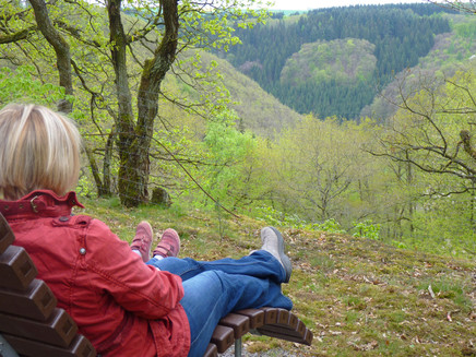
We set out from the barbecue hut of Zilshausen, which is located at the edge of the forest, a short way out of town. The Dünnbach route immediately dives into a varied mixed woodland, leading us down into the valley past a lookout and an old quarry. At a rocky ridge shortly thereafter we happen upon the lookout point “Heierts Stück”: A path here leads to a bench where one can enjoy the view down into the pristine valley.
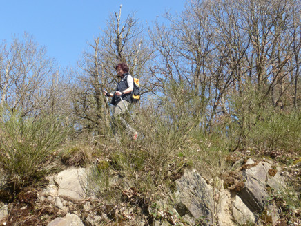
We next pass through an archaic, low-growth woodland on a beautiful forest path. The rocky outcrops all along the way afford insights into Earth’s history. The path then ultimately ascends a little again along the edge of the slope of the Petershauser Graben rift before sharply turning back to the left towards the valley of the Dünnbach stream in the middle of a conifer forest.
Here we happen upon a forestry road after about 2 km where we can change to the right-hand connection route that divides the Dünnbach hike into a southern (from Zilshausen: 5.5 km) and a northern loop (from Lahr: 6.1 km). The Dünnbach Trail now turns 15 meters to the right before leading down to the Dünnbach stream itself by footsteps. An access route leads to Mörsdorf from here (2.6 km), and a nearby rest area allows us to enjoy a picnic directly by the water.
The Dünnbach Trail continues on to the right across a meadow and follows the leat for a short stretch, but next turns uphill into the slope, steeply at first, but then somewhat more moderately.
We soon reach the K38 road, which is crossed later. This is followed by a magnificent forest passage that leads directly to the Dünnbach stream. The tour now follows the snaking brook and we see gorgeous nature. All too quickly, after 4 km, we have to bid the valley farewell because this is the start of the ascent to Lahr. Wonderful views into the distance open up as soon as we leave the forest, which we can particularly savour in the resting area by the Lahr Biotope. Then the path leads to Lahr with a few swerves, where an access route links up the town centre.
We quickly reach the open field again, briefly following a cart track along the L 108, before going back into the forest along the Petershauser Graben rift. After a descent, we hit upon the connection route after almost 8 km, in the Zwergenplatz area at a large forest crossing.
The Dünnbach Trail now leads uphill to the left along a broad forestry path. We finally turn to the right into a path that leads to the edge of the forest after a last steep stretch. From there we follow a cart track that goes gently uphill to nearby Zilshausen.
The tour turns right at the main road, goes around the church and then leads out of town. We are walking right across the open land with the most beautiful panoramic view, and on to a wayside cross. The Dünnbach trail continues straight on at first, but then sharply turns to the right in the middle of the fields, before happening upon the access road at the barbecue hut a little later. We are not going there on the road, however, but on the strip of grassland running parallel to it. This charming hike ends at the barbecue hut again after 10 km altogether.
Safety Guidelines
Die Traumschleifen haben teilweise steile, schwierige und bei Regen- oder Winterwetter rutschige Passagen. Deshalb sind
Trittsicherheit und gute Kondition unbedingte Voraussetzungen zum Erwandern dieser Premiumrundwanderwege.
Equipment
Festes Schuhwerk (Wanderschuhe) wird dringend empfohlen.
Tip
The virtually untouched valley of the Dünnbach stream in the Rhineland-Palatinate is the highlight of this hike, but the panoramic views near Lahr and Zilshausen are also impressive.
Getting there
Von der Hunsrückhöhenstraße (B327) auf Höhe Kastellaun über die L 108 nach Zilshausen oder über die L204 nach Mörsdorf und Lahr.
Parking
Parkplatz an der Grillhütte Zilshausen
Lage: N50° 06´ 35.8´´ E7° 22´26.5´´
Parkplatz Ortsmitte Lahr (Zuweg 350 m)
Lage: N50° 07´ 34.7´´ E7° 21´55.4´´
Zuwegung 2,6 km ab Ortsmitte Mörsdorf
Public transit
Zilshausen und Lahr eingeschränkt mit dem ÖPNV erreichbar:
Buslinien 650 + 637 (Umstieg in Beltheim), Montag-Freitag, mehrmals täglich
oder den Buslinien 736 oder 741 von Treis-Karden
Mörsdorf eingeschränkt mit dem ÖPNV erreichbar:
Bus Linie 742 von Treis-Karden
Infos auf www.vrminfo.de
Literature
Kostenlos:
Broschüre "Erlebnis Traumschleifen" mit Wegskizzen, Höhenprofile, Kurzbeschreibungen und Einkehrtipps zu allen 111 Traumschleifen
und Traumschleifen-Übersichtskarte - leichte Faltkarte mit grober Lageübersicht aller 111 Traumschleifen
Infos und Anforderung auf www.saar-hunsrueck-steig.de/prospekte
Kostenpflichtige Reiseführer und Bücher im Shop auf www.saar-hunsrueck-steig.de
Additional Information
Tourist-Information Kastellaun, Marktstraße 16, 56288 Kastellaun
Tel. 06762 401873, www.kastellaun.de
Hunsrück-Touristik GmbH, Gebäude 663, 55483 Hahn-Flughafen
Tel. 06543 507700, www.hunsruecktouristik.de
Weather

This tour is presented by: Hunsrück, Author: Iris Müller


