Traumpfädchen Riedener Seeblick
- start: 56745 Rieden, Am Waldsee Rieden
- destination: 56745 Rieden, Am Waldsee Rieden
- easy
- 5,03 km
- 1 hour 45 minutes
- 157 m
- 487 m
- 361 m
- 60 / 100
- 10 / 100
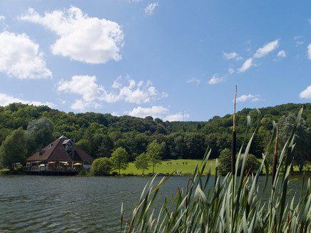
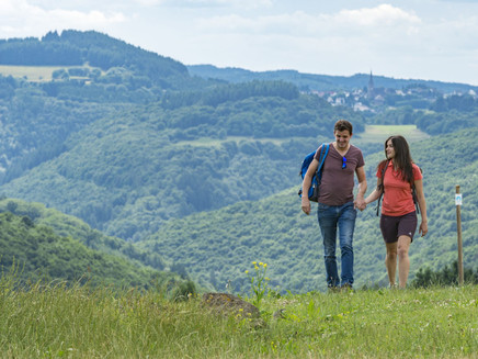
Varied forest and meadow sections with fantastic long-distance views and extraordinary insights into the fiery past of the Eifel. A highlight is the picturesque Waldsee Rieden.
Highlights at the Traumpfädchen
- Idyllically located Waldsee Rieden
- Refreshment at the Kneipp facility in Rieden
- Sauerbrunnen in Rieden
- Panoramic views into the Eifel
Impressions
General information
Directions
The short access path begins at the parking lot of the Rieden reservoir up to the dam, where the portal of the Traumpfädchen is located. Due to the incline, it is advisable to complete the route counterclockwise. Therefore, you first turn to the steeply ascending Waldseestraße and hike uphill through the holiday home settlement. Soon the last houses are left behind and while meadows open to the right, forest accompanies the path on the left. The embankment offers great geological insights into the fiery past of the Vulkaneifel.
At the "Auf dem Perich" junction, half of today's elevation gain is achieved and you can turn left onto a paved forest path. Passing a shelter, the path now leads first through forest, then through open fields, until you finally turn left onto a grass path. The ground springs underfoot, which continues as you hike noticeably uphill again with a right bend.
As the path flattens, you can already see the next shelter ahead and soon you reach the Udeleck viewpoint at the highest point of the circuit. By the way, the wonderful view can be especially enjoyed from the dream lounger.
Without changing direction, you then walk along the forest edge with a good view of Rieden. At the end of the grove, the path bends downhill and you lose a considerable amount of height through fields and meadows, before the path turns left and reaches an asphalt road. Here you only go uphill for 50 m, then you use a field path to the right. At the first opportunity, turn right and reach "In der Aspel", the first houses. But nature calls again and you walk in a scenic position above the village. Soon you really enter the village, where you turn left to the Kneipp facility after crossing the Rehbach. Shortly thereafter, the Sauerbrunnen offers a refreshment of a different kind.
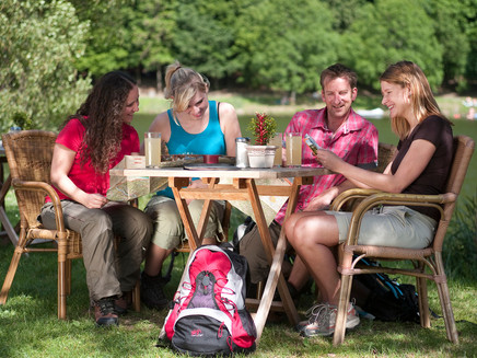
Alongside the Rehbach, you quickly approach the lake. You may half-circle it on the well-maintained lakeside path at the end. After 5.2 km, when you are back at the portal, you can end the route at one of the dining options by the lake before returning to the parking lot.
Safety Guidelines
General safety instructions:
Safety instructions – Safe hiking on the Traumpfädchen
Hikers want narrow paths, natural trails (over forest floor, grass paths or along streams) and rocky ascents leading to spectacular views. It is, of course, necessary to walk such paths with special attention.
What you should consider during your hike:
- Wear weather-appropriate, functional clothing that protects you from cold and wet conditions or heat and sun.
- Plan your hike with reasonable breaks and conserve your strength.
- Take enough fluids with you. There are not dining options everywhere.
- Please wear suitable hiking boots that provide enough grip on slippery, steep, rocky and uneven paths.
- If you think certain path sections are not passable for you, you should bypass or turn back. Especially during adverse weather conditions, natural paths can become muddy and slippery.
- In autumn, be especially aware that fallen leaves can hide uneven ground, roots, stones or holes on the path.
- You must expect such path impairments when hiking.
- Check online before your hike at https://www.traumpfade.info/traumpfaedchen/wege-status/ whether the Traumpfädchen you want to hike is possibly closed, if there are detours, planned construction works or tree felling or other disturbances.
- Recommended hiking months: April to October.
Equipment
The Traumpfädchen are not suitable for strollers or walkers.
Path closures can be found at: https://www.traumpfade.info/traumpfade/wege-status/
Tip
If you are planning a longer route by the lake, then we recommend the Traumpfad Waldseepfad Rieden.
Getting there
A61 exit Wehr, direction Adenau/Kempenich - B412 turn right towards Wehr/Rieden - turn left at L114, through Rieden to the Waldsee (parking lot signposted)
56745 Rieden, Am Waldsee
Parking
56745 Rieden, Waldsee Rieden (parking lot) - fee required
Public transit
Destination stop: Rieden, Waldsee
Line 399 FreizeitBus: Mayen - Rieden - Maria Laach - Nickenich - Andernach - Namedy (04/01 to 11/01)
Line 820 Mayen Ost Station – Rieden - Kempenich
Literature
- A Beautiful Day "traumpfädchen", Ulrike Poller & Wolfgang Todt, ISBN: 978-3-942779-49-4,
- Traumpfade & Traumpfädchen Volume 2: The 19 Best Premium Circular Hikes in the Vordereifel, Ulrike Poller & Wolfgang Todt ISBN: 978-3-934342-61-3
Additional Information
Tourist Info Laacher See, Tel.: 02636/19433, info@vulkanregion-laacher-see, www.vulkanregion-laacher-see.de
Project office Traumpfade, Tel.: 0261/108419, info@traumpfade.info, www.traumpfade.info
Traumpfade app
Traumpfade app for iOS: Download app from iTunes
Traumpfade app for Android: Download app from Google Play
Weather

This tour is presented by: Traumpfade im Rhein-Mosel-Eifel-Land, Author: Nicole Pfeifer


