Traumpfad Waldschluchtenweg
- start: 56179 Vallendar, Feisternachbachtal parking lot (L309)
- destination: 56179 Vallendar, Feisternachbachtal parking lot (L309)
- medium
- 10,75 km
- 3 hours 30 minutes
- 296 m
- 277 m
- 111 m
- 80 / 100
- 60 / 100
The path runs along idyllic brook valleys and primeval floodplain landscapes. On narrow paths and enchanted forests, it passes Roman relics.
Highlights on the Traumpfad
- Feisternachtbachtal
- Limes (UNESCO World Heritage)
- idyllic brook valleys
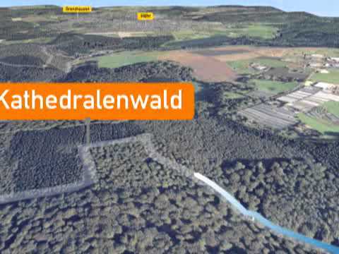
Impressions


General information
Directions
The starting point is the Feisternachtbachtal parking lot. The path crosses the L309 and the Hillscheider Bach and runs above the brook through middle-height mixed forest past steep rock cliffs and the fish ponds of the Tannenhof. The path crosses the L309 again. It ascends in switchbacks and continues upstream along the Hirzbach valley. Through old high forest, it first goes gently, then steeply uphill around the Kuckucksberg. At the height, the path leads right to the Middle Pedelweg.
On a velvety soft forest path, it passes the waterworks to the Bembermühle. The following ascent leads to the Limes wall hidden in the forest, a relic from Roman times. Before the first houses of Höhr-Grenzhausen, the path almost parallels the flank of the Puschenkopf and continues to the Saustallkopf. In wide switchbacks, the path now descends into the Feisternachtbachtal, crosses the brook, and follows the left bank downstream to a small lake with a hut and further back to the starting point.
Safety Guidelines
Safety instructions - Safe hiking on the Traumpfade
Hikers desire narrow paths, natural trails (over forest floor, grassy paths or along streams) and rocky ascents leading to spectacular views. It is, of course, necessary to walk such paths with particular care.
What you should consider on your hike:
- Wear weather-appropriate, suitable clothing that protects you from cold and wet as well as heat and sun.
- Plan your hike with appropriate breaks and conserve your energy.
- Take enough fluids with you. Refreshment stops are not available everywhere.
- Please wear appropriate hiking boots that provide sufficient support also on slippery and steep or rocky and uneven paths.
- If you consider certain sections impassable for you, you should bypass or turn back. Especially in adverse weather conditions, natural trails can have muddy and slippery passages.
- Particularly in autumn, note that fallen leaves on the ground can conceal irregularities, roots, stones or holes in the path.
- You must expect path impairments of this kind during your hike.
- Check online before your hike at https://www.traumpfade.info/traumpfade/wege-status/ whether the Traumpfad you want to hike is possibly closed, whether detours exist, or whether path construction measures, logging or other disturbances are present.
- Recommended hiking months: April to October.
Difficulty classification
Easy routes
… feature only minor elevation differences and can usually be managed in half a day regarding distance. They do not require special fitness or surefootedness. There are no sections requiring freedom from dizziness. Shorter steep sections are possible. Depending on the path, some parts may be difficult to walk when wet.
Medium routes
… can be managed well with normal fitness. Path sections may require good surefootedness, so sturdy footwear is important; hiking poles can be useful. Some somewhat longer and steeper ascents and descents are possible. Difficult (partly secured) passages are the absolute exception and can usually be avoided by detours. Natural sections can be difficult to walk when wet.
Difficult routes
… require very good fitness and endurance due to length and/or elevation gain. Very good surefootedness is needed to manage steep ascents and descents on partly demanding paths. Rope-secured sections and/or simple climbing passages requiring a minimum of freedom from dizziness are possible. Sturdy footwear and hiking poles are important. Paths and exposed sections are often difficult or impossible to walk during wet or wintry weather.
Equipment
Sturdy footwear is recommended for the route!
You can find path closures at: https://www.traumpfade.info/traumpfade/wege-status/
Getting there
B 42 to Vallendar - L 308 direction Höhr-Grenzhausen - L 309 direction Hillscheid
56179 Vallendar, Feisternachbachtal parking lot (L309)
Parking
56179 Vallendar, Feisternachbachtal parking lot (L309)
Public transit
Destination stop: Vallendar, Schönstatt
Line 437 Vallendar (station) - Höhr-Grenzhausen
from Koblenz main station (bus platform B):
Line 150 (direction Höhr-Grenzhausen) to stop: Schillerstraße Höhr-Grenzhausen – change to line 437 (direction Vallendar) – destination stop: Schönstatt
Line 8 (direction Bendorf – Sayn) to stop: station, Vallendar – change to line 437 (direction Höhr-Grenzhausen) – destination stop Schönstatt
Literature
- Traumpfade & Traumpfädchen Volume 1: The 18 best premium circular hikes along the Rhine and Moselle, Ulrike Poller & Wolfgang Todt ISBN: 978-3-942779-64-7
- 27 Premium Circular Traumpfade Routes, 10 Years Traumpfade Anniversary Edition, Ulrike Poller & Wolfgang Todt, ISBN: 978-3-942779-43-2
Maps
Topo map "Upper Middle Rhine Valley/Koblenz (1:25,000) ISBN: 978-3-89637-363-2
Additional Information
Vallendar Municipal Association, Rathausplatz 13, Tel.: 0261/6503192, www.vg-vallendar.de
Traumpfade Project Office, Tel.: 0261/108419, info@traumpfade.info, www.traumpfade.info
Traumpfade app
Traumpfade app for iOS: Download the app on iTunes
Traumpfade app for Android: Download the app on Google Play
Weather


This tour is presented by: Traumpfade im Rhein-Mosel-Eifel-Land