Traumpfad Rheingoldbogen
- start: 56321 Brey at the cemetery
- destination: 56321 Brey at the cemetery
- medium
- 12,57 km
- 4 hours
- 292 m
- 257 m
- 96 m
- 80 / 100
- 40 / 100
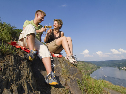
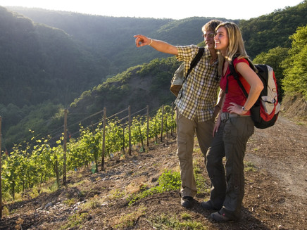
In the footsteps of the Romans and viticulture, through diverse landscapes, past well-kept vines and primeval hedges onto the Rhine plateau with fantastic views over the Rhine valley and the Rhine bend.
Highlights on the Traumpfad:
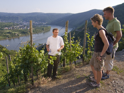
- Fantastic views into the Rhine valley and of the Rhine bend at Osterspai (UNESCO World Heritage: Upper Middle Rhine Valley)
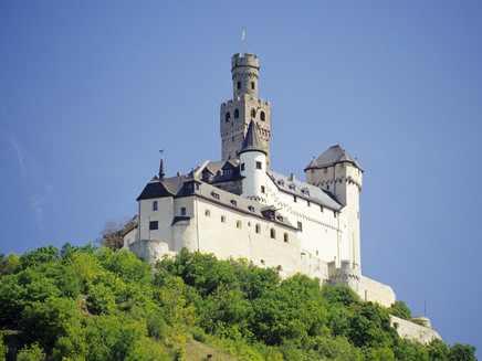
- Dreamlike views of the Marksburg in Braubach
- Historical vineyards of the Bopparder Hamm
- Brey
- Rhine plateau
- Jakobsberg monastery
- Chapel of the Virgin Mary
Impressions
General information
Directions
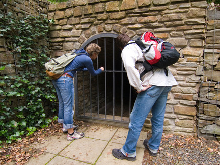
From the starting point Brey/Cemetery, the path soon leads into the forest. Here, shafts open up a view of old water conduits built by the Romans. At the Brey sports ground, a narrow path climbs steeply to a shelter with a great view towards the Rhine valley. On soft forest paths, it continues to the Rhine plateau. Unremarkable elevations in the forest conceal a considerable tumulus grave field. The path curves around this area and reaches the former Jesuit monastery Jakobsberg, now used as a hotel with a golf course. On forest paths, it goes downhill towards Peternach. The path reaches the famous vineyards of the Bopparder Hamm, where a panoramic view opens up of the largest Rhine bend with views of Boppard, Filsen, and Osterspai. Accompanied by dense hedges, the path turns its back on the Rhine valley. The flat highland offers phenomenal views of the Marksburg, which seems within reach. Across open fields, the meadow path reaches the Chapel of the Virgin Mary. The path now leads downhill and runs down an idyllic meadow path back to the starting point Brey.
Safety Guidelines
Safety instructions - safe hiking on the Traumpfade
Hikers desire narrow paths, natural trails (over forest floor, grassy paths, or along streams), and rocky ascents that lead to spectacular views. It goes without saying that such paths must be walked with special attention.
What you should consider on your hike:
- Wear weather-appropriate, suitable clothing that protects you from cold, wetness, or heat and sun.
- Plan your hike with adequate breaks and conserve your energy.
- Bring enough fluids. There are not always opportunities for refreshments.
- Please wear hiking shoes appropriate for the Traumpfad that provide sufficient support even on slippery, steep, rocky, and uneven paths.
- If you think certain sections are not passable for you, you should avoid or turn back. Especially in adverse weather conditions, natural paths can become muddy and slippery.
- Especially in autumn, note that fallen leaves can hide unevenness, roots, stones, or holes in the path.
- You must expect path impairments of this kind when hiking.
- Check online before your hike at https://www.traumpfade.info/traumpfade/wege-status/ to see if the Traumpfad you want to hike is possibly closed, if detours exist, or if path construction work, logging work, or other disturbances are planned.
- Recommended hiking months: April to October.
Difficulty classification
Easy routes
...have only slight elevation changes and can usually be managed in half a day in terms of distance. They do not pose special demands on fitness or surefootedness. No sections require a fear of heights. Short steeper sections are possible. Depending on path format, some parts may be difficult to walk in wet weather.
Medium routes
...can be managed well with normal fitness. Path sections may require good surefootedness, so sturdy shoes are important; hiking poles can be useful. Some longer and steeper ascents and descents are possible. Difficult (partly secured) sections are extremely rare and can usually be avoided by detours. Natural sections can be difficult to walk in wet weather.
Difficult routes
...require very good fitness and endurance due to length and/or elevation gain. Very good surefootedness is also necessary to manage steep ascents and descents on sometimes challenging paths. Rope-secured sections and/or simple climbing passages requiring a minimum degree of fearlessness may be possible. Sturdy footwear and hiking poles are important. Paths and exposed sections are often difficult or impossible to walk on in wet or wintry weather.
Equipment
Firm footwear is recommended for the route!
Path closures can be found at: https://www.traumpfade.info/traumpfade/wege-status/
Getting there
B9 to Brey - turn into Rheingoldstraße in Brey - drive to the parking lot directly at the village square (between house numbers 14 and 18) - 56321 Brey, village square (Rheingoldstraße)
Parking
Start 56321 Brey:
56321 Brey, village square (immediately on Rheingoldstraße between house numbers 14 and 18 / 200 meters access to the Rheingoldbogen)
Saturdays from 3 pm and Sundays all day: 56321 Brey, Kochhan company (Mainzer Straße 1). From there, a marked path to the Traumpfad is available.
Start 56321 Spay:
In Spay, the Rheingoldbogen can be reached via 2 access routes:
56322 Spay, Zehnthofstraße (700 meters access to the Rheingoldbogen)
Parking options: 56322 Spay, Zehnthofstraße / parking spaces at the cemetery
or
56322 Spay, Ecker Mainzer Straße/Im Lehnacker (1.5 kilometers access to the Rheingoldbogen)
Parking options: 56322 Spay along Mainzer Straße
Public transit
Destination stop: Brey, B9
Line 670 RegioBus: Koblenz-Rhens-Spay-Boppard
Destination stop: Spay, Alter Posthof (200m to the access path "Im Lehnacker")
Line 670 RegioBus: Koblenz-Rhens-Spay-Boppard
Literature
- Traumpfade & Traumpfädchen Volume 1: The 18 best premium circular hikes on the Rhine and Moselle, Ulrike Poller & Wolfgang Todt ISBN: 978-3-942779-64-7
- 27 premium circular routes Traumpfade, 10-year anniversary edition Traumpfade, Ulrike Poller & Wolfgang Todt, ISBN: 978-3-942779-43-2
Maps
- Topographic map "Upper Middle Rhine Valley/Koblenz (1:25,000) ISBN: 978-3-89637-363-2
Additional Information
Tourist Information Erlebnis Rheinbogen, Tel.: 02607/49651, touristik@erlebnis-rheinbogen.de,www.erlebnis-rheinbogen.de
Project office Traumpfade, Tel.: 0261/108419, info@traumpfade.info, www.traumpfade.info
Traumpfade app
Traumpfade app for iOS: Download app on iTunes
Traumpfade app for Android: Download app on Google play
Pavings
- Asphalt Coating (11%)
- Hiking Trail (57%)
- Path (32%)
Weather

This tour is presented by: Traumpfade im Rhein-Mosel-Eifel-Land
