Traumpfad Pellenzer Seepfad
- start: 56645 Nickenich, Laacher Straße, parking lot at the tumulus
- destination: 56645 Nickenich, Laacher Straße, parking lot at the tumulus
- difficult
- 15,96 km
- 5 hours
- 594 m
- 420 m
- 246 m
- 80 / 100
- 80 / 100
Unique insights into the volcanic past at Eppelsberg, live volcanism at Laacher See with a view of Maria Laach Abbey, views of the Krufter Waldsee and outlooks into the Pellenz.
Highlights on the Traumpfad:
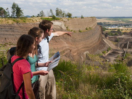
- Ash wall of the Laacher See volcano
- Krufter Waldsee
- Rock ledge Teufelskanzel
- Laacher See with a view of the Benedictine Abbey Maria Laach
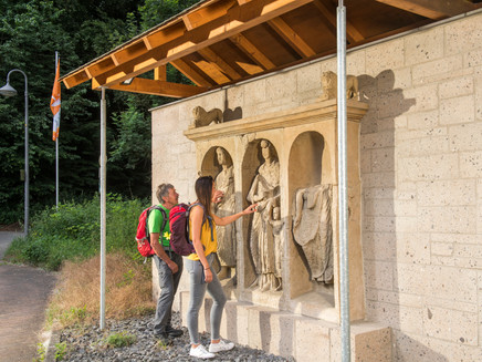
- Nickenich Tumulus
Impressions
General information
Directions
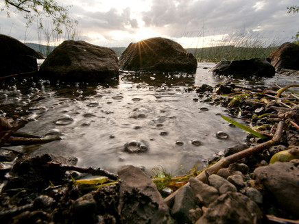
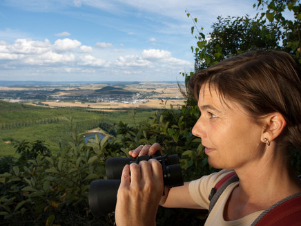
The route starts at the parking lot near the Roman tumulus in Nickenich. The path first circles an idyllic valley before a short ascent leads past the impressive ash wall (Black Wall), which the Laacher See volcano left behind 13,000 years ago. The location also impresses with a wide-ranging view of Nickenich. After a short climb, a detour to rest at the Hermann Hut with its magnificent panoramic view is worthwhile. Then the path gently descends and leads to the edge of the open-pit mine at Eppelsberg. After a relaxing passage through mixed forest, past owl, eagle, and squirrel, you reach the rest area at Krufter Waldsee. The summit attack begins on moderately ascending forest paths, but shortly before the rock it goes steeply up along an impressive rock niche to the rock ledge Teufelskanzel with a fantastic distant view towards Kruft and the Neuwied Basin (an easier alternative route is available). A comfortable ridge path leads to the shelter "Am Krufter Ofen", then it goes down in switchbacks, with further sensational views and through a mighty beech forest. Over open fields, the path leads to Laacher See and offers first views of Maria Laach Abbey and the Eifel heights behind it. Along the nearby shore, a detour to the lakeside is worthwhile; here, CO2 gas rises visibly from the depths and forms countless bubbles, the so-called mofettes.
Soon the path turns right and climbs steeply 100 meters in altitude to the Ahrefeld shelter. Afterwards, comfortable forest roads and crossing the L 116 first lead through mixed forest to the Celtic tree circle, an ideal place to rest. On the following stretch, grand views open into the Brohl valley and up to the peaks of the Siebengebirge. Through pine and birch forests, another fantastic distant view of the Siebengebirge and the Pellenz opens at the spoil tip on the Hummerich. Along the forest edge, through open land and mixed forest avenue, it goes in a curve around the sports field back to the Roman grave.
Safety Guidelines
Sure-footedness and a head for heights are required on some sections. This path should not be hiked when icy.
General safety instructions:
Safety instructions – safe hiking on the Traumpfade
Hikers want narrow paths, natural trails (over forest floors, grass paths or along streams) and rocky ascents that lead to spectacular views. It is of course essential that such paths are traversed with special attention.
What you should consider during your hike:
- Wear weather-appropriate, functional clothing that protects you from cold and wet or heat and sun.
- Plan your hike with appropriate breaks and use your strength sparingly.
- Take enough fluids with you. There are not always food and drink opportunities available.
- Please wear appropriate hiking shoes for the Traumpfad, which give you enough support even on slippery and steep or rocky and uneven paths.
- If you think that certain sections of the path are not passable for you, then you should bypass or turn back. Especially in adverse weather conditions, there can be muddy and slippery sections on natural paths.
- Be especially aware in autumn that fallen leaves on the ground may hide unevenness, roots, stones or holes in the path.
- You must expect such path impairments when undertaking a hike.
- Check before your hike on the internet at https://www.traumpfade.info/traumpfade/wege-status/ whether the Traumpfad you plan to hike is perhaps closed, if there are detours, if construction work is planned, or for example, tree-felling work or other disturbances are taking place.
- Recommended hiking months: April to October.
Difficulty classification
Easy routes
… have only minor altitude differences and can mostly be completed in half a day in terms of distance. They place no special demands on fitness and surefootedness. There are no sections requiring a head for heights. Shorter steeper sections are possible. Depending on path format, parts may be difficult to walk in wet weather.
Intermediate routes
… can be mastered well with normal fitness. Path sections may require good surefootedness, so sturdy footwear is important; hiking poles can be useful. Some somewhat longer and also steeper ascents and descents are possible. Difficult (partly secured) passages are the absolute exception and can usually be avoided by detours. Natural sections can be difficult to walk in wet weather.
Difficult routes
… require very good fitness and endurance due to length and/or altitude to be covered. Very good surefootedness is necessary to master steep ascents and descents on sometimes demanding paths. Secured sections with ropes and/or simple climbing passages requiring a minimum degree of surefootedness are possible. Sturdy footwear and hiking poles are important. Paths and exposed sections are often difficult or impossible to pass in wet or winter weather.
Equipment
Sturdy footwear is recommended for the route!
Path closures can be found at: https://www.traumpfade.info/traumpfade/wege-status/
Getting there
A61 exit Kruft - B256 to Kruft - L119 towards Nickenich - parking lot at the tumulus
56645 Nickenich, Laacher Straße, parking lot at the tumulus
Parking
56645 Nickenich, Laacher Straße, parking lot at the tumulus
56645 Nickenich, parking lot Keller Kreuz (L 116)
56642 Kruft, parking lot at the Waldsee (K 53)
56653 Maria Laach, Benedictine Abbey Maria Laach (parking fee: 2 €)
Public transit
Destination stop: Nickenich, Oberdorf
Line 395 Niedermendig - Maria Laach - Nickenich - Andernach
Destination stop: Kruft, train station
RB 23 Kaisersesch-Mayen-Andernach - Pellenz-Eifel route (Lahn-Eifel railway)
RB 38 Kaisersesch-Mayen-Andernach - Pellenz-Eifel route (Lahn-Eifel railway)
Literature
- Traumpfade & Traumpfädchen Volume 2: The 19 best premium circular hikes in the Vordereifel, Ulrike Poller & Wolfgang Todt ISBN: 978-3-934342-61-3
- 27 Premium Circular Routes Traumpfade, Anniversary Edition 10 years Traumpfade, Ulrike Poller & Wolfgang Todt, ISBN: 978-3-942779-43-2
Additional Information
Tourist Information Maria Laach, Tel.: 02636/19433, info@vulkanregion-laacher-see, www.vulkanregion-laacher-see-de
Project office Traumpfade, Tel.: 0261/108419, info@traumpfade.info, www.traumpfade.info
Traumpfade App
Traumpfade App for iOS: Download app on iTunes
Traumpfade App for Android: Download app on Google Play
Weather

This tour is presented by: Traumpfade im Rhein-Mosel-Eifel-Land, Author: Nicole Pfeifer
