Traumpfad Nette-Schieferpfad
- start: 56753 Trimbs, village square (Auf dem Reusch)
- destination: 56753 Trimbs, village square (Auf dem Reusch)
- medium
- 9,19 km
- 3 hours 30 minutes
- 295 m
- 285 m
- 172 m
- 100 / 100
- 40 / 100
... through the idyllic river landscape of the Nette, the path goes over narrow paths past rugged slate cliffs. Insights into slate mining, magnificent views, and adventures in the tunnel of a former railway line splendidly complete this path.
Highlights on the Traumpfad
- Nettle Valley Nature Reserve
- "Trimbser Schweiz"
- Panoramic view Burberg
- Former railway tunnel
- View of the Nette viaduct
- Slate rock formations
Impressions


General information
Directions
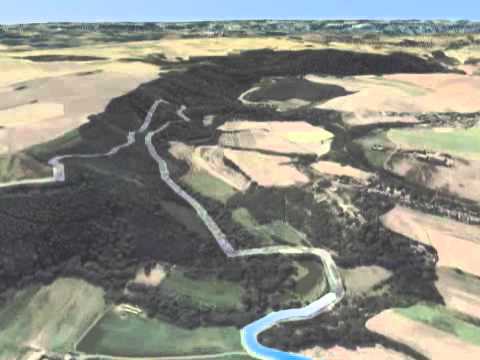
Over the stone Nette bridge in Trimbs, the path leads into the blooming floodplain of the Nette. Initially following the babbling little river, it goes uphill on soft grassy paths. Over rare dry meadows and past rugged slate cliffs, the Trimbser Schweiz is soon reached, where a magnificent view of Trimbs and Welling awaits. Further along the path, the hiker passes through extensive fields up to the Burberg, where a wonderful panoramic view of the Nette valley opens up. Along the edge of the slope, the path descends again into the Nette valley. Once in the valley, the hiker follows a beautiful natural path along the murmuring Nette. Through light floodplain forests, the path ascends slowly but steadily until the mighty portal of the Hausen 2 tunnel is reached. Adventurous spirit and railway romance seize the hiker while walking through the 250 m long, illuminated tunnel. At its end, unique views of the Nette viaduct await before the path continues into the quiet forest. Following the forest edge, there are repeatedly splendid views before the steep descent back into the Nette valley takes place. Along the river, through narrow side valleys, the destination in Trimbs is reached after a few kilometers.
Safety Guidelines
+++ In some sections, surefootedness and a head for heights are required. This path should not be walked in ice and snow. +++
+++ From December to March, flooding danger after heavy rain. +++
General safety instructions:
Safety instructions - Safe hiking on the Traumpfade
Hikers desire narrow paths, natural paths (over forest floor, grassy tracks, or along streams), and rocky ascents leading to spectacular views. It is of course essential that such paths be walked with special attention.
What you should keep in mind during your hike:
- Wear weather-appropriate, functional clothing that protects you from cold and wet as well as heat and sun.
- Plan your hike with reasonable breaks and use your strength sparingly.
- Take enough fluids with you. There are not everywhere opportunities to refresh.
- Please wear appropriate hiking shoes for the Traumpfad that provide sufficient support on slippery and steep or rocky and uneven paths.
- If you think certain sections are not passable for you, you should bypass or turn back. Especially in adverse weather conditions, natural paths may have muddy and slippery passages.
- In autumn, also note that fallen leaves may conceal unevenness, roots, stones, or holes in the path.
- You should expect such path impairments when undertaking a hike.
- Before your hike, check on the internet at https://www.traumpfade.info/traumpfade/wege-status/ whether the Traumpfad you want to hike is possibly closed, if detours exist, if construction or logging work or other disturbances occur.
- Recommended hiking months: April to October.
Difficulty classification
Easy routes
... have only slight elevation differences and are usually manageable in half a day in terms of distance. They do not put special demands on fitness and surefootedness. No sections require a head for heights. Short steeper sections are possible. Depending on the path type, some parts may be difficult to walk in wet weather.
Medium routes
... are manageable with normal fitness. Path sections may demand good surefootedness, so sturdy shoes are important, walking sticks may be useful. Some somewhat longer and steeper ascents and descents are possible. Difficult (sometimes secured) passages are very rare and can usually be avoided by detours. Natural sections may be difficult to walk in wet weather.
Difficult routes
... require very good fitness and stamina due to length and/or elevation difference. Very good surefootedness is also needed to manage steep ascents and descents on sometimes demanding paths. Secured rope sections and/or simple climbing passages requiring a minimum head for heights are possible. Sturdy shoes and walking sticks are important. Paths and exposed sections are often difficult or impossible to walk in wet or winter weather.
Equipment
Sturdy footwear is recommended for the route!
Path closures can be found at: https://www.traumpfade.info/traumpfade/wege-status/
Tip
Getting there
A 48 exit Polch - continue via L 113 to Trimbs
56753 Trimbs, parking lot at the sports field (Hauptstraße 31)
Parking
56753 Trimbs, parking lot at the sports field (Hauptstraße 31)
56753 Welling, village square (Schulstraße)
Public transit
Destination stop: Trimbs, Nette bridge
Line 360 RegioBus: Münstermaifeld - Mertloch - Polch - Hausen - Mayen
Literature
- Traumpfade & Traumpfädchen Volume 2: The 19 best premium circular hikes in the Vordereifel, Ulrike Poller & Wolfgang Todt ISBN: 978-3-934342-61-3
- 27 Premium Circular Trails Traumpfade, 10-year anniversary edition Traumpfade, Ulrike Poller & Wolfgang Todt, ISBN: 978-3-942779-43-2
Maps
Recreational map Mosel "Maifeld and Lower Mosel" (1:25,000), ISBN: 978-3-944620-16-9
Additional Information
Tourist Information Maifeld, Tel.: 02605/9615026, touristik@maifeld.de, https://www.maifeld.de/tourismus-kultur/
Traumpfade Project Office, Tel.: 0261/108419, info@traumpfade.info, www.traumpfade.info
Traumpfade App
Traumpfade app for iOS: Download app on iTunes
Traumpfade app for Android: Download app on Google Play
Weather


This tour is presented by: Traumpfade im Rhein-Mosel-Eifel-Land, Author: Nicole Pfeifer