Traumpfad Höhlen- und Schluchtensteig
- start: 56626 Andernach-Kell car park Bergwege (on the K 57)
- destination: 56626 Andernach-Kell car park Bergwege (on the K 57)
- medium
- 12,44 km
- 3 hours 30 minutes
- 297 m
- 328 m
- 116 m
- 100 / 100
- 60 / 100
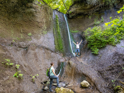
Mighty cliffs, tuff caves waiting to be explored, a jungle atmosphere in the Wolf’s Pit with its unique waterfall and bubbling springs at the wayside; impressive alternating sleepy brook valleys and panorama views.
Highlights at Traumpfad
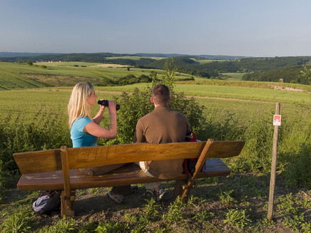
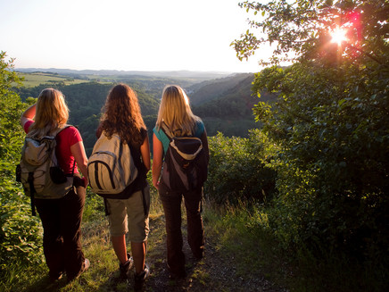
- Panoramic views “Schöne Aussicht” (Beautiful View) and “Schweppenburgblick” (Schweppenburg View)
- Viaduct for the volcano express
- Tuff walls of the Lake Laacher volcano
- Tuff caves
- Ruins of the Tönisstein monastery
- Idyllic brook valleys
- Unspoilt Wolf’s Dell with its waterfall
- Bubbling mineral springs at the side of the path
Impressions
General information
Directions
Directly after the start at the car park near the K57, the first panoramic view is revealed in the direction of Pöntertal. Field footpaths lead through the wide plain revealing again and again new views, past gnarled fruit trees to the descent down to the idyllic Krayerbach valley. Billowing reeds and huge hedges line the way down to Kryermühle (Kryer Mill). Watercourses accompany the hiker down to the deeply carved Pönterbach valley. And soon the path goes steeply upwards to the refuge hut, and shortly afterwards, a detour to the viewpoint “Schweppenburgblick”. The further course of the trail is characterised by lovely views of the volcanic landscape.
The path, now called the Hermanns-Löns-Pfad, continues along a rock slope steeply downwards to the Jägerheim Inn (closed Inn). Here the path goes under the mighty viaduct, over a meadow through man-high walkable tuff caves. Tuff walls and the remains of the Tönisstein monastery can be discovered at the side of the path before it enters the Wolf’s Dell. Fantastic rock formations, jungle atmosphere, bubbling springs in the brook’s bed, and even a waterfall can be seen here.
The way continues on the L113 long the edge of the forest, slightly uphill to the Roman spring, where water containing CO2 and having a slight smell of sulphur bubbles out of it. The path curves into a tranquil side valley, past another bubbling spring, and then left along an uphill forest path on to an alpine plateau that reveals the impressive “Siebengebirgsblick”. Soon the starting point is reached.
Safety Guidelines
In some passages surefootedness and a head for heights is required. The trail should not be hiked in icy conditions.
Safety guidance – stay safe whilst hiking on the Traumpfade/Traumpfädchen
Hikers like narrow pathways, unspoilt natural trails (leading over the forest floor, across the grass or alongside streams) and rocky climbs which lead to spectacular views. It goes without saying that particular care should be exercised when taking such routes.
Things to bear in mind when preparing for your hike
- Wear proper clothing that is appropriate to the weather conditions and that will protect you against the cold and the wet or the heat and the sun.
- Schedule suitable breaks during your hike and make sure that you conserve energy.
- Take sufficient liquids with you. Establishments selling refreshments are not available everywhere.
- When hiking on the Traumpfade, please wear appropriate hiking boots which provide a sufficient foothold on slippery, steep, rocky and uneven paths.
- If you do not feel that you are able to negotiate certain parts of the route, then you should avoid such sections or else turn back. Natural pathways may become muddy and treacherous, especially in unfavourable weather.
- In autumn in particular, please remember that leaves lying on the ground may be concealing bumps, routes, stones or holes in the path.
- You will need to expect route impairments of this kind if you are intending to undertake a hike.
- Before setting out, visit https://www.traumpfade.info/traumpfade/wege-status/ in order to find out whether the route you intend to hike is closed or whether diversions are in place. Construction works, timber felling or other disruptions may also be planned.
- Recommended hiking season: April to October.
Difficulty rating:
Easy tours
...have only slight differences in altitude and can usually be completed in half a day in terms of distance. They are not particularly demanding in terms of fitness and surefootedness. There are no sections of the trail that require a head for heights. Short, steeper sections are possible. Depending on the trail format, some sections may be difficult to walk in wet weather.
Medium tours
...are easy to manage with a normal level of fitness. Path sections may require good sure-footedness, so sturdy footwear is important, hiking poles may be useful. Some longer and steeper ascents and descents are possible. Difficult (partly secured) passages are the absolute exception and can usually be avoided by taking a detour. Natural sections can be difficult in wet weather.
Difficult tours
...require very good stamina and endurance due to the length and/or the meters of altitude to be covered. You also need to be very sure-footed to tackle steep ascents and descents on sometimes challenging paths. Rope-secured sections and/or easy climbing passages, which require a minimum of freedom from shingles, are possible. Sturdy footwear and hiking poles are important. Paths and exposed passages are often difficult or even impossible to walk in wet or wintry weather.
Equipment
Sturdy shoes are recommended for the tour!
You can find trail closures at: https://www.traumpfade.info/traumpfade/wege-status/
Tip
- The road is currently very busy, especially on weekends and holidays. We recommend that you switch to weekdays (Mon-Fri) if possible.
- If the parking lot Bergwege is full, please use the parking lot in Andernach-Kell (Pöntertalstraße). From here there is a marked access road to the Traumpfad. Parking along the county road (K58) is strictly prohibited. Please understand that parking along the county road considerably impairs agriculture.
- Please check whether it is possible to travel by public transport and refrain from using your own car.
Getting there
A 61 Exit Niederzissen - B 412 in the direction of Brohl-Lützing/Burgbrohl/Bad Breisig - via the L113 on the K58 to Kell - Laacher Road (K 57) up to the car park
Parking
56626 Andernach-Kell, car park Bergwege (on the K 57)
56626 Andernach-Kell, Bürgerhaus car park (Pöntertalstraße)
Public transit
Destination stop:Kell, mountain trails (from Andernach train station)
Line 310 (direction Dorfplatz Plaidt) to Eich, Dorfplatz - from Eich, Dorfplatz Line 312 (direction Wassenach, Unterdorf)
Destination stop: Kell, village square (from Andernach train station)
Line: 310 RegioBus: Plaidt-Kruft/Kell - Nickenich -Eich - Andernach station Lohmannstrasse
Destination stop: Jägerheim (from Brohl train station)
Line: 808 Brohl-Burgbrohl-Niederlützingen-Brohl
Destination stop: Jägerheim (from the train station, Brohltalstraße, Niederzissen)
Line: 807 Wassenach
Destination stop: Bad Toenisstein train station / Jägerheim
Brohltalbahn "Vulkan-Express" (daily except Monday)
Literature
- Traumpfade & Traumpfädchen Band 1: Die 18 besten Premium-Rundwanderungen an Rhein und Mosel, Ulrike Poller & Wolfgang Todt ISBN: 978-3-942779-64-7
- 27 Premium-Rundwege Traumpfade, Jubiläumsausgabe 10 Jahre Traumpfade, Ulrike Poller & Wolfgang Todt, ISBN: 978-3-942779-43-2
Additional Information
Andernach.net, Tel.: +49 (0)2632/9879480, info@andernach.net, www.andernach-tourismus.de
Projektbüro Traumpfade, Tel.: +49 (0)261/108419, info@traumpfade.info, www.traumpfade.info
Traumpfade-App
Traumpfade-App für iOS: App bei iTunes download
Traumpfade-App für Android: App bei Google play download
Weather

This tour is presented by: Traumpfade im Rhein-Mosel-Eifel-Land, Author: Nicole Pfeifer


