Moselsteig Stage 04: Konz – Trier
- start: Konz: Konz main train station in Bahnhofstraße
- destination: Trier: Trier main train station
- medium
- 21,06 km
- 6 hours
- 538 m
- 385 m
- 125 m
- 40 / 100
- 60 / 100
On the trace of the Romans.
A stage completely dedicated to the old Romans: The starting point is Konz, once not only the gateway to the city of Trier, but also the seat of Emperor Valentinian's summer residence. After crossing the Mosel, there is the option to make a detour to the UNESCO World Heritage Site Igeler Säule – a richly decorated Roman tomb, which with its 23 meters height today is considered the largest Roman pillar tomb north of the Alps. On the following route, nature surprises despite the proximity to the Mosel metropolis Trier with its lushness. A short steep section finally leads down into the Busental. A connecting path leads into the oldest city in Germany – and to its world-famous, well-preserved Roman buildings and UNESCO World Heritage Sites such as the Porta Nigra. The university city also offers a lively and very charming old town.
Impressions
General information
Directions
From Konz main train station, the Moselsteig approach trail marking quickly leads you to the start point of the stage at the Saar roundabout at the Saar bridge. On the way to a successful hiking day, you will pass the tourist information and the information board about the Moselsteig. A sight in Konz is the imperial palace Konz. Discover it in its original appearance. For this purpose, download the free ARGO app and call up an augmented reality application on your smartphone or tablet, which shows you the original building as if it were still unchanged in its place. The free app and further information about the imperial palace can be found at www.ar-route.eu. Before continuing your hike, if needed, use the dining and supply options along Granastraße and at Konz stop; there are not many on the further way towards Trier.
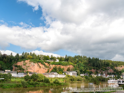
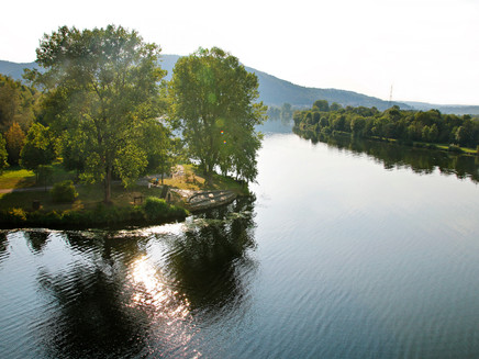
The Moselsteig has to cross the railway line and several roads before reaching the Konzer railway bridge at the Kreuz Konz stop. This is the first Mosel crossing for all Moselsteig hikers walking the Moselsteig downstream. From the bridge, you have a good view of the river around the Saar estuary. Once on the other Mosel bank, you have the choice: you can now also take the path towards Wasserbilligerbrück and visit the impressive Igeler Säule (Roman tomb).
On the way to Zewen, the Moselsteig runs very flat through the river valley meadow. You go under the B 49, and now comes the quite rare unbarred crossing of a railway track (please be very careful!). At Wasserbilliger Straße, the connection to the town center branches off. The Moselsteig leads upwards to the forest edge and passes quiet residential streets. You reach the last steep section uphill to the forest edge via footpaths.
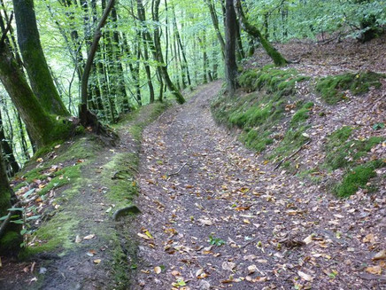
Through the closed forest, it goes further uphill, first moderately, later steeper, to the shelter at K 2. The nearby road hardly disturbs here; it offers a break, after all, you have already done the biggest part of the ascent on this stage! After a few meters along the road, it continues slightly uphill in the valley of the Zewener creek; the creek now comes closer to the path. After roughly rounding the small district of Herresthal, you reach a resting place between pastures of cows and horses. Over meadow paths you come to the model airfield on the ridge. From here, you should look south: a wonderful panorama opens, and you can even see the Löschemer chapel (on the other Mosel side above Wasserliesch), one of the highlights on the Nittel – Konz stage! Almost always along the ridge, the view now alternates between the South Eifel and the view over the Mosel into the Hunsrück.
After crossing a road, the Moselsteig continues a short section on the ridge before it steeply descends parallel to an asphalted path at the edge of a large meadow. In the forest, you make fast progress; the path runs without bigger changes in altitude in wide loops around the Mohrenkopf. Bright beech forest alternates now with denser Douglas fir stands. Some specimens have considerable size. This longer forest section ends at the access road to the Trier district Markusberg. After a few meters on the access road (tip for refreshments: Café Mohrenkopf), the Moselsteig surprisingly changes to a path that steeply descends over a meadow into the Busental. Be careful on this section especially when wet! Further, the grass path gently descends into the idyllic valley. Here you can experience absolute peace – and so close to the big city Trier!
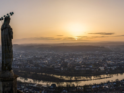
In the forest, it continues mostly on a slightly descending path. After the junction of a side valley, you meet the path to the Mariensäule. The detour via the steep and strenuous connecting path is definitely worthwhile because the place below the Mariensäule offers probably the most beautiful view of the Roman city Trier! The Moselsteig continues a little further through the forest before it changes at the forest edge into a grass path. Ancient fruit trees on the right and left complete the idyllic picture. On a boardwalk, you cross the Sirzenicher creek, then you reach Bitburger Straße in Trier-Pallien. (From here, a bus goes directly to Trier city center.)
The Moselsteig leads through the university campus and meets at the park of the Drachenhaus the connection path to the center. From there or to the main train station, it goes steeply downhill to the Mosel bridge. Let your gaze wander calmly over the city one last time before. Over the Kaiser Wilhelm bridge, you are quickly on the opposite Mosel bank. Then comes a pleasant walk through the green areas of Alleenring and past the Porta Nigra to Trier main train station.
Equipment
- sturdy footwear
- weather-appropriate, suitable hiking clothing
- rucksack meals
Tip
A stage for warm days because it leads a lot through the shady forest or over airy heights.
Getting there
Start point: Konz via B 419 and B 51
End point: Trier via A 602 or via B 51/B 49
Parking
Konz: Parking is available near Konz main train station and at the Konz Mitte stop.
Trier: There are no free parking spaces at the main station or in the city center; near Trier University, the Weisshauswald hiking parking lot can be used.
Public transit
You can reach the stage towns Konz (Konz Mitte station or Konz central station) as well as Trier (central station) by train (RB 82, 71, 83, RE 1)
There are regular connections. Please note that during school holidays of Rhineland-Palatinate / Saarland, on weekends and on public holidays, there can be schedule limitations! Please check the daily current timetables on the website of the Transport Association Region Trier (VRT):
Literature
"Moselsteig" - Official Moselsteig hiking guide by ideemedia, €14.95
Authors: Ulrike Poller, Wolfgang Todt, Publisher: ideemedia, 300 pages with almost 300 pictures, elevation profiles, QR codes and GPS tracks, format 11.5 x 23 cm, ISBN: 978-3-942779-21-0, €14.95
"Official Moselsteig hiking maps" in pocket format:
The entire route is divided into 3 maps:
Leisure map Moselsteig - Map 1: Perl - Trier (Stages 1 - 4), ISBN: 978-3-89637-419-6
Leisure map Moselsteig - Map 2: Trier - Zell (Mosel) (Stages 5 -14), ISBN: 978-3-89637-420-2
Leisure map Moselsteig - Map 3: Zell (Mosel) - Koblenz (Stages 15 - 24), ISBN: 978-3-89637-421-9
Single map: €5.90
3 map set: €14.50 (ISBN: 978-3-89637422-6)
"Premium set"
Premium set, consisting of official hiking guide including 3-map set, publisher: ideemedia, ISBN: 978-3-942779-24-1, €26.95
The hiking guides and maps are available in bookstores or on the website https://www.visitmosel.de/wandern/service-infos-tipps under the section "Brochure order".
Maps
Leisure map Moselsteig - Map 1: Perl - Trier (Stages 1 - 4), ISBN: 978-3-89637-419-6
Additional Information
Mosellandtouristik GmbH
Kordelweg 1, 54470 Bernkastel-Kues; Phone: +49 (0)6531/97330
Saar-Obermosel-Touristik e. V.
Saarstraße 1, 54329 Konz; Phone: +49 (0)6501/6018040
Tourist Information Trier
An der Porta Nigra, 54290 Trier; Phone: +49 (0)651/97808-0
Weather

This tour is presented by: Mosel. Faszination Urlaub, Author: Mosellandtouristik GmbH

