Moselsteig Side Trail Saar-Riesling-Steig
- start: Parking at the Schoden sports field or railway stop Schoden
- destination: Parking at the Schoden sports field or railway stop Schoden
- difficult
- 18,43 km
- 6 hours
- 610 m
- 480 m
- 143 m
- 80 / 100
- 100 / 100
Forests, meadows, vineyards and sweeping views.
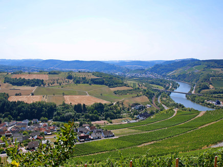
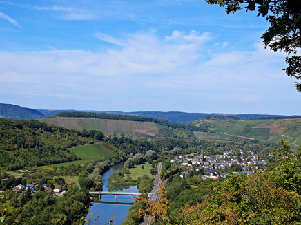
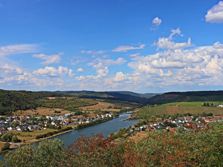
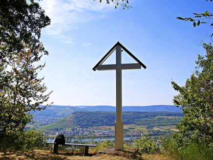
The Saar-Riesling trail thrills with its variety of landscape and nature experiences and fascinating views of the Saar valley. Sunny vineyards in well-known vineyard locations alternate with dense deciduous and coniferous forests and idyllic creek valleys. A special feature of the Saar-Riesling trail is the option of three access points: in Schoden, at the sports ground, in Wiltingen at the Geispiffer Hut and in Ockfen at the Angelweiher. From each of these starting points you can hike in ever changing landscapes boasting vineyards, deciduous and coniferous forests, creeks, mountain meadows and magnificent views of the Saar Valley and the forests at the Geisberg. Special highlights include the viewpoints at the Schleidkreuz at the Saar steep slope and at the Heppenstein. The climbing tour at the Bockstein and a stop at the Bismarckturm complete your perfect hike.
Impressions
General information
Directions
At the starting point at the parking area at the sports field an information board provides information about the course of the Side Trail. From here, you first hike to the underpass of the railway line and main road. This is also an entry point for hikers who took the train. Continue uphill to the outskirts of the town. Here, the path reaches the Marienkapelle. From here, the Side Trail leads though the forest, but still steeply uphill. Through a small cross-valley and after changing direction, you reach a bench which offers you the first view of the Saar Valley. Further up, a short detour takes you to the Schleidkreuz viewing point. You should not miss out on hiking these extra 200 m. From the cross you have a wonderful view of Schoden, the Saar with the lock and the Saar Channel and the surrounding vineyards.
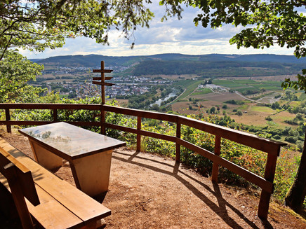
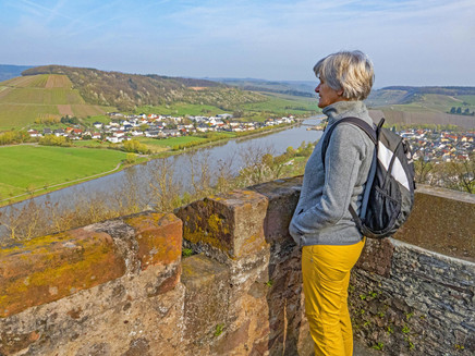
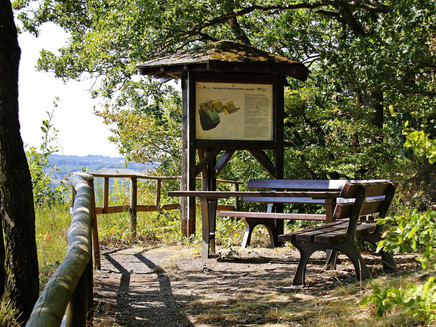
Returning from this detour, the Side Trail now continues as a path through the forest. This section is easy to hike as the path has a soft surface and no great inclines or declines. Soon you arrive at a large meadow with fruit trees, where you follow the edge. The Side Trail crosses the open plateau and leads along the wooded slope edge. At a small meadow, the view opens up again. View of the Saar Valley. The path again crosses the plateau and after a short section the Saar-Riesling Trail returns to the slope edge. Here, we hike through a beautiful oak forest. Following a gently sloping path, the "Am Saar-Steinhang" viewing point is quickly reached. With the beautiful view from the benches to the Saar Valley with the nature reserve "Wiltinger Saarbogen" you should definitely take a break.
Continue downhill to the remains of a Westwall bunker. A short, moderately steep section downhill, but later on a steep path, the view of the church of Wiltingen opens up. Once you have arrived at the bottom you can enjoy the view of the surrounding vineyards while resting on a lounger. The path now leads to the Zippborntal. First, the path climbs uphill on the western side of the valley, after crossing the stream it then leads a short section down the valley. Here, you reach the turn-off to the Geispifferhütte Wiltingen, which can also be used as a starting point for the Saar-Riesling Trail.
The Side Trail now continues uphill in the Zappborntal. There are boards along the trail in the forest which are part of forest nature trail. The ascent to the Zappborn is a total of about 2.5 km, sometimes steeper, sometimes flatter. The path also varies from being close to the stream and then further away from it. At the top the valley gets narrower and while the oaks dominate in the bottom part, at the top there are mainly beech trees. At the Zappborn, the path crosses the stream, which usually is dry here. The following section is ideal for taking a breather after the long climb. The path leads flat through the forest. At a large meadow, the ascent continues. From here you have an expansive distant view. On the one side the view opens up Saarburg and on the other, the Moselle Valley. You can see Igel and Konz and even a small part of the Sauertalbrücke of the motorway can be made out. You can enjoy the panorama view even longer on the provided lounger.
For everyone who cannot tear themselves away from the view, the path still continues a little uphill. On a winding path through the forest.The subsequent, wider path passes a transmission mast. This is the highest part of the entire hike. Through a light, sunny forest populated mainly with oak trees, you continue downhill until you reach a signpost. If you like, you can take a detour to the nearby Kroh-Kreuz. There is also a rest area.
Now the Saar-Riesling Trail continues steeply downhill. First as a path, then as a forest path. The small side valley enters a larger one. Here the slope is not as steep any more. The old slate walls in the forest indicate the old vineyard sites. The path ascends again and leaves the valley floor. From the vineyard area you now have a wide view to the west towards Saarburg. The Side Trail increases steeply in a side valley. However, you do not follow the valley right to the top, but change on to a forest path on the same height, which takes you to a viewing point above the vineyards. A perfect place for a rest, because the view towards Saarburg and down to Ockfen is spectacular.
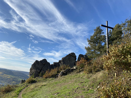
Between the forest and the vineyard you continue gently uphill. Then it gets alpine. After some steps, a rocky section follows to the Bockstein, a weathered-free rock massif. If you like, you can climb up to the summit cross.After a section through the forest the Saar-Riesling Trail arrives back in the vineyards. The Heppenstein viewing point with is rest place invites to another stopover. From the path in the vines and forest the tail then continues into the forest. Steeply downhill it then reaches the Bismarck Tower on a track. The view from the small viewing tower is another highlight of the Saar-Riesling Trail. A beautiful view of the Saar Valley!
The road leads straight to the intersection below the Marienkapelle. From here, the railway stop or parking area is quickly reached and the Side Trail ends.
Safety Guidelines
The passage on the Bockstein can be slippery when wet!
Please note that there are no refreshment stops or shopping facilities on the direct route. We recommend that you plan detours to the villages. Please check the opening hours of the respective inns/restaurants/wine taverns before your hike: https://www.saar-obermosel.de/wein/gastrofuehrer#/pois
Equipment
Please ensure you are wearing sturdy shoes.
Tip
For anyone who does not want to hike the full 18.4 kilometres, the hike can be shortened via the Geisberg Plateau from any of the three possible starting points.
Getting there
B 51 between Trier and Saarburg, the fastest way to reach Schoden is via Wiltingen
Parking
Large parking area at the Schoden sports field, directly at the starting point of the Side Trail
Public transit
The Schoden-Ockfen train stop is served by the regional train every hour.
Information on current public transport timetables can be found at www.bahn.de or www.vrt-info.de
Literature
Literature (only available in German):
"Moselsteig Side Hikes 1 - The most beautiful circular routes between Trier and Bernkastel-Kues" by ideemedia
Authors: Ulrike Poller, Wolfgang Todt, Publisher: ideemedia, 144 pages, Format: 11.0 x 16.4 cm, ISBN: 978-3-942779-59-3, 12.95 €
Additional Information
Saar-Obermosel Tourism e. V.
Saarstr. 1, 54329 Konz, Tel. 06501-6018040
Graf-Siegfried-Str. 32, 54439 Saarburg, Tel. 06581-995980,
https://www.facebook.com/saarobermosel
https://www.instagram.com/saarobermosel
https://www.youtube.com/channel/UCkcqfebcdiSYLAAj_qIxsBQ
Mosellandtouristik GmbH
Kordelweg 1, 54470 Bernkastel-Kues, Tel. 06531-97330
Pavings
- Unknown (95%)
- Hiking Trail (2%)
- Crushed Rock (1%)
- Asphalt Coating (1%)
- Path (1%)
Weather

This tour is presented by: Saar-Obermosel-Touristik e.V , Author: Saar-Obermosel-Touristik e.V.
