Konstantinweg - Hike N2 Nittel
- start: Nittel, sports ground
- destination: Nittel, sports ground
- easy
- 6,32 km
- 1 hour 35 minutes
- 96 m
- 317 m
- 255 m
- 80 / 100
- 20 / 100
A historically significant easy hike around Nittel.
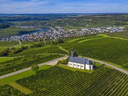
The incredibly easy hike with few inclines begins at the sports ground and passes open meadows and fields. A magnificent view of Luxembourg opposite is guaranteed.
Impressions
General information
Directions
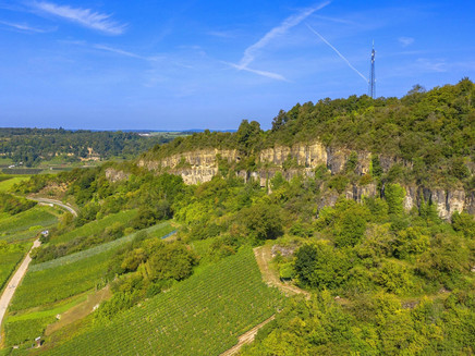
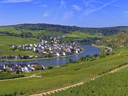
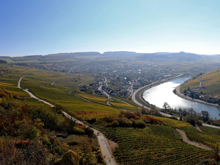
The best-known Nittel legend tells of the battle between the Franks and the Romans on the "Kamp-Plateau" above the cliffs. When Constantine the Great was eight months old, his mother Helena had to wage war against the Franks. According to the legend, Constantine, lying in a golden cradle, and Helena could have been present in the Roman camp above Nittel. The historically significant easy hike begins at the sports ground, passes open meadows and fields, through the small forest "Reinbüsch," and along a long meadow path above the cliffs with magnificent views of the village, the Moselle, and Luxembourg opposite. Passing the Windhof pond complex, it returns to the starting point.
The hike is continuously marked with the sign "N2."
Equipment
Sturdy footwear!
Getting there
You can reach Nittel from Perl or Konz via the B 419. From Saarburg, you can reach Nittel via the L 135.
Parking
Some free parking spaces are available at the sports ground in Nittel (on L 135 in the Windhof district).
Public transit
DB line Trier - Perl with RB 82 to Nittel station.
Information on current local public transport schedules is available at www.bahn.de or www.vrt-info.de/busnetz.
Literature
Tips and information as well as free brochures and map material for the holiday region Saar-Obermosel are provided by Saar-Obermosel Touristik through the tourist information offices in Konz (Tel. 06501-6018040) and Saarburg (Tel. 06581-995980).
Or order the desired brochures directly from our online brochure shop.
Tip: Saar-Obermosel guest newspaper, Saar-Obermosel leisure map.
Maps
The local hiking map with the precise route guidance is available free of charge at accommodation establishments in Nittel, the village bakery, and the Moselle pharmacy in Nittel.
The map is also available from Saar-Obermosel Touristik at the tourist information offices in Konz and Saarburg.
The hiking map "Holiday Region Saar-Obermosel" at a scale of 1:35,000 is available for €8.95 at the tourist information offices in Konz and Saarburg.
Or order the map directly from our online brochure shop.
Additional Information
Saar-Obermosel Touristik, Tourist Information Saarburg, Graf-Siegfried-Str. 32, 54439 Saarburg, Tel. 06581-995980.
Saar-Obermosel Touristik, Tourist Information Konz, Saarstr. 1, 54329 Konz, Tel. 06501-6018040.
Email: info@saar-obermosel.de
Visit our website with exclusive tips and information about the holiday region Saar-Obermosel and follow us on social media channels:
https://www.saar-obermosel.de/
https://www.facebook.com/saarobermosel
https://www.instagram.com/saarobermosel
https://www.youtube.com/@saarobermosel4183
More information about a stay in Nittel can be found at: https://www.nittel-mosel.de/
Pavings
- Asphalt Coating (1%)
- Crushed Rock (50%)
- Hiking Trail (44%)
- Path (5%)
Weather
This tour is presented by: Saar-Obermosel-Touristik e.V , Author: Saar-Obermosel-Touristik e.V.
