Circular Route Kenn (R2)
- start: Kenn town centre; roundabout Trierer Str./ Bahnhofstr./ St. Margarethenstraße
- destination: Kenn town centre; roundabout Trierer Str./ Bahnhofstr./ St. Margarethenstraße
- medium
- 6,32 km
- 1 hour 50 minutes
- 119 m
- 249 m
- 132 m
- 60 / 100
- 40 / 100
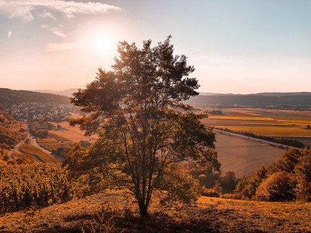
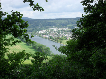
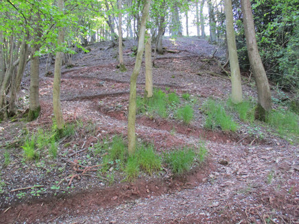
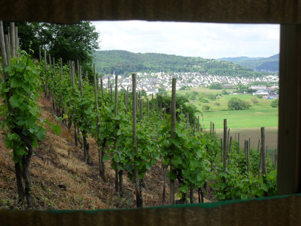
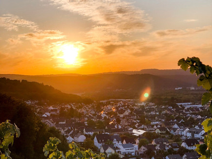
The start and finish point of the Kenner Panoramic Circular Route R 2 is located at the Kenn town hall. It initially leads the hiker along St. Margarethenstraße to the town exit towards Schweich. Afterwards, the walker is guided through the Kenner vineyards up 17 hairpin bends to the plateau with views of Schweich, Issel, and Kenn.
Impressions
General information
Equipment
Sturdy footwear.
Getting there
You can also reach the local municipality of Kenn very well via the A 602. Exit at the Kenn motorway junction and then take the L 145 to Kenn.
Parking
There are parking spaces at Kenn town hall (start and finish point of the route).
Public transit
By bus line 220 from Trier via Ruwer, Schweich, Mehring, Leiwen, Trittenheim to Neumagen.
More information about the detailed timetable at: https://www.vrt-info.de/
Or enter the bus line 220 directly on the VRT timetable page in the input mask: https://www.vrt-info.de/fahrplanauskunft/XSLT_SELTT_REQUEST?itdLPxx_page=ttb&itdLPxx_contractor=vrt&language=de
Maps
New: Hiking map 1 : 25,000 Vacation region Schweich on the Roman Wine Road
ISBN: 978-3-944620-13-8.
Schweich (Mosel). With the latest MOSEL hiking map titled “ Vacation region Schweich on the Roman Wine Road ”, the Eifelverein supplements its series of hiking maps on the Mosel with now the fourth hiking map at a scale of
1 : 25,000. This series of hiking maps, published by the Eifelverein in collaboration with Moselland Tourism and the tourist information offices of the affected municipalities, will complete the Eifelverein's map collection after the completion of all MOSEL hiking maps with the Mosel run in the southeast.
The new hiking map replaces, with slightly modified sheet layout, the previously outdated hiking map “Neumagen-Dhron, Schweich on the Roman Wine Road” issued by the State Office for Surveying and Geobasis Information Rhineland-Palatinate. The hiker is reliably guided on the hiking routes in the vacation region Schweich along Moselsteig, Saar-Hunsrück-Steig, side routes, and dream loops. The Meulenwald hiking area is also depicted on the map.
With Moselsteig and Saar-Hunsrück-Steig, two long-distance hiking trails awarded as "Germany’s most beautiful hiking trail" run through the vacation region Schweich on the Roman Wine Road. Not only with the connected circular hiking trails called “side route” and “dream loop” does the vacation region Schweich on the Roman Wine Road form an extensive and varied network of hiking trails. This hiking trail network is complemented by sections of the Eifelsteig with two partner trails, the Moselhöhenweg, further main trails of the Eifelverein, and numerous regional hiking trails also included on the new map. Selected are also some cycling routes and five mountain bike routes on the Roman Wine Road depicted on the map.
Despite the extensive hiking and leisure offerings shown on the map, the Moselsteig stages 5, 6, 7, and 8 as well as the five side routes “Longuicher Sauerbrunnen,” “Zitronenkrämerkreuz,” “Mehringer Schweiz,” “Klüsserather Sagenweg,” and “Moselachter” form the core piece of this new hiking map. Especially the four Moselsteig stages and the five side routes are described in the map’s inner section not only textually in two languages but also with an elevation profile display and indications of the hiking difficulty.
The basis for this detailed hiking map is the official topographic map 1 : 25,000 from the State Office for Surveying and Geobasis Information Rhineland-Palatinate. The map uniformly costs 7.90 EUR and is available at the Tourist Information Roman Wine Road, Brückenstraße 46, 54338 Schweich, at Moselland Tourism and in bookstores, and of course also at Eifelverein e. V., Stürtstraße 2 - 6 in 52349 Düren. The map can also be ordered online around the clock at www.eifelverein.de . ISBN: 978-3-944620-13-8.
Additional Information
Information:
Tourist Information Roman Wine Road
Tel. 0049 (0)6502/ 9338-12
e-mail: info@roemische-weinstrasse.de
Internet: www.roemische-weinstrasse.de
Pavings
- Street (28%)
- Crushed Rock (36%)
- Hiking Trail (13%)
- Path (22%)
Weather
This tour is presented by: Verein Römische Weinstraße e.V., Author: Jochen Conrad
