Traumpfädchen Virneburger Burgblicke
- start: 56729 Virneburg, community hall (In der Au 6)
- destination: 56729 Virneburg, community hall (In der Au 6)
- easy
- 3,51 km
- 1 hour 15 minutes
- 135 m
- 428 m
- 381 m
- 80 / 100
- 10 / 100
The magnificent Nitzbach Valley Varied vegetation, rugged rocky cliffs and magnificent views of the ruined fortress of Virneburg are our constant companions on this superb panoramic trail. We make our way across the idyllic flood plains of the beautiful Nitzbach Valley before conquering the ruins to enjoy the fabulous vista downwards.
Highlights of the Traumpfädchen
- Ruined fortress of Virneburg
- Nitzbach Valley
- Eifel panorama
- Rocky and panoramic pathway
Impressions
General information
Directions
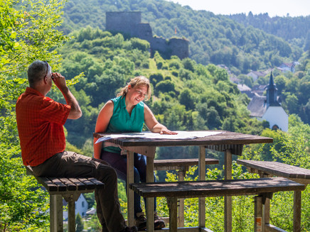
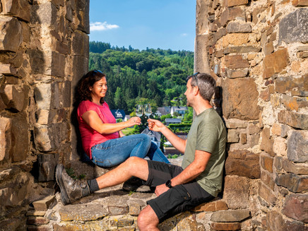
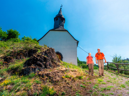
The Traumpfädchen Virneburger Burgblicke begins at the car park of the village hall in the centre of Virneburg. This is a tour which will very much live up to its name! The recommendation is that the route should be completed in an anti-clockwise direction in order to enjoy the views to the fullest extent possible. We therefore turn our backs on the village hall and walk to the nearby B 258 main road, which we cross. A comfortable footpath quickly leads out of the built-up area and into the idyllic flood plain of the Nitzbach Valley. The Nitzbach flows its way across the valley floor, sometimes peacefully and occasionally effervescently. This section of the route already offers relaxation despite being located only a little below the B 258. After 0.8 kilometres, a bridge takes us over the Nitzbach. The Traumpfad and the Traumpfädchen meet at this point. Together they wend their way gently upwards to the left on a woodland trail. We ignore any turn-off's and continue to ascend step by step. The branches of the trees permit constant glimpses of Virneburg and of the ruined fortress of the same name. But time also passes quickly in natural surroundings such as these. Our interest is drawn by the varied vegetation and the rugged rocky cliffs. Immediately before reaching the first houses, we arrive at a small rocky promontory with a bench. The view of the ruined fortress, which greets us form the opposite slope, is highly impressive. Our curiosity grows. We follow a narrow pathway down into the village, cross the B 258 once more and continue straight ahead. We need to pay attention, however. The Traumpfädchen quickly veers off to the left and uses steps to ascend to the rocky pathway below the ruin. We now enjoy magnificent panoramic views as we proceed as far as the chapel. We then take a sharp right turn and need to overcome a brief but steep climb in order fully to conquer the ruin. Once we have reached the top, it is time to take a breather and to enjoy the superb views of the village and the valley. The route continues right through the ruin itself. We soon swing to the left and walk around the mountain on which it stands. Our descent back into the valley begins at a fork in the trail. After a few twists and turns, we again come to a bridge which will take us over the Nitzbach. We now embark upon a brief climb out of the village to the point where the Traumpfädchen and Traumpfad meet for the last time. The two sets of logos point the way into the forest, where we take a sharp left turn and head for the edge of the slope. The Virneburg viewing point, a rest area offering box seat views, now awaits us! Continuing to enjoy the views, we descend into the village. Our entertaining tour then ends back at the car park.
Safety Guidelines
Safety guidance – stay safe whilst hiking on the Traumpfade/Traumpfädchen
Hikers like narrow pathways, unspoilt natural trails (leading over the forest floor, across the grass or alongside streams) and rocky climbs which lead to spectacular views. It goes without saying that particular care should be exercised when taking such routes.
Things to bear in mind when preparing for your hike
- Wear proper clothing that is appropriate to the weather conditions and that will protect you against the cold and the wet or the heat and the sun.
- Schedule suitable breaks during your hike and make sure that you conserve energy.
- Take sufficient liquids with you. Establishments selling refreshments are not available everywhere.
- When hiking on the Traumpfade, please wear appropriate hiking boots which provide a sufficient foothold on slippery, steep, rocky and uneven paths.
- If you do not feel that you are able to negotiate certain parts of the route, then you should avoid such sections or else turn back. Natural pathways may become muddy and treacherous, especially in unfavourable weather.
- In autumn in particular, please remember that leaves lying on the ground may be concealing bumps, routes, stones or holes in the path.
- You will need to expect route impairments of this kind if you are intending to undertake a hike.
- Before setting out, visit https://www.traumpfade.info/traumpfaedchen/wege-status/ in order to find out whether the route you intend to hike is closed or whether diversions are in place. Construction works, timber felling or other disruptions may also be planned.
- Recommended hiking season: April to October
Equipment
Surefootedness and a head for heights are required in some sections.
You should not embark upon the tours in icy conditions.
Robust footwear is recommended!
Details of route closures can be found at: https://www.traumpfade.info/traumpfaedchen/wege-status/
The Traumpfädchen are not suitable for prams or rollator users.
Tip
Wenn Sie die Virneburg noch länger genießen möchten, dann empfehlen wir Ihnen den Traumpfad Virne-Burgweg.
Getting there
A 48 exit Mayen/Mendig - B 258 direction Nürburgring - to Virneburg community hall
56729 Virneburg, community hall (In der Au 6)
Parking
56729 Virneburg, Community Hall (In der Au 6)
Public transit
Destination stop: Virneburg, bridge
Line 388 FreizeitBus: Mayen-Langenfeld-Arft-Herresbach-Kürrenberg-Mayen (01.04. to 01.11.)
Line 381 (Mayen-)Kürrenberg-Virneburg-Herresbach-Welschenbach
Literature
Ein schöner Tag Eifel/Mosel/ Rhein Traumpfädchen, Ulrike Poller & Wolfgang Todt, ISBN: 978-3-942779-456-3
Additional Information
Touristik-Büro Vordereifel, Tel.: +49 (0)2651/800995, tourismus@vordereifel.de , www.naturerlebnis-vordereifel.de
Projektbüro Traumpfade, Tel. +49 (0)261/108419, info@traumpfade.info, www.traumpfade.info
Traumpfade App
Traumpfade App for iOS: Download the app from iTunes
Traumpfade App for Android: Download the app from Google Play
Pavings
- Asphalt Coating (14%)
- Crushed Rock (26%)
- Hiking Trail (37%)
- Path (23%)
Weather

This tour is presented by: Traumpfade im Rhein-Mosel-Eifel-Land, Author: Nicole Pfeifer
