Traumpfädchen Paradiesweg Polch
- start: 56751 Polch, car park at the Schützenhalle (Am Blumenberg)
- destination: 56751 Polch, car park at the Schützenhalle (Am Blumenberg)
- easy
- 7,24 km
- 2 hours 15 minutes
- 69 m
- 235 m
- 166 m
- 80 / 100
- 20 / 100
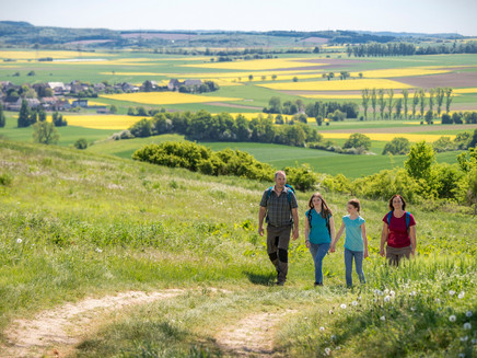
You travel relaxed on natural paths through fields and meadows and along the idyllic Polcher Bach towards Polch. Unique are the panoramic views over the Maifeld and to the volcanic cones of the Osteifel.
Highlights on the Traumpfädchen
- Maifeld panorama
- Polcher Bach valley
- Natural paths through fields and meadows
- View of volcanoes in the Osteifel
- Nature reserve
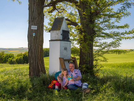
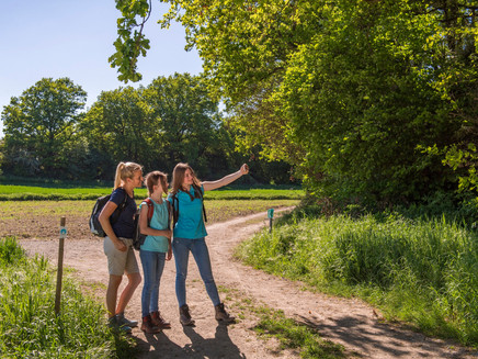
Impressions
General information
Directions
The relaxed circular route on the Paradiesweg Polch begins at the car park of the Schützenhaus Polch. The best way to enjoy the panoramic views is to hike clockwise. Therefore, from the Schützenhaus, you first walk comfortably uphill through a small forest, before fields line the path after a slight ascent for the first time.
With a few detours, you conquer the plateau around Blumenberg and have Kaan, a district of Polch, well in view. The route gently leads down to a side street. After crossing it, a small forest and thickets provide variety, while step by step the route ascends again with some changes of direction. These are the surroundings of Uhlenberg and Kuckertsberg, now explored on always natural paths. This section of the Paradiesweg is characterized by magnificent wide views over the Maifeld. Wide fields flank the path and the view extends almost endlessly around. The collegiate church of Münstermaifeld stands out prominently, and on the horizon, the typical cone-shaped volcanoes of the Osteifel line up, which can be especially enjoyed after 1.7 km from a curved forest bench on the hillside edge (50 m detour from the path).
In the open countryside, a gnarled tree stretches its crown to the sky, and a little later the route gently turns downhill. A resting place offers a box seat view before descending the valley with several bends.
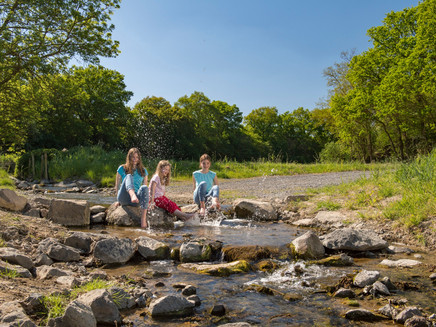
Down below, it is the Polcher Bach, which now provides a pleasant framework with meadows and thickets. Occasionally rocks border the path, giving insight into the ancient bedrock of the region. Again and again, the little stream comes into focus.
Anyone who wishes and has no problem with additional elevation can take a path detour after 4.7 km up to the Kolping cross, where two benches invite you to enjoy the view after 250 m.
When the thickets finally give way, the Paradiesweg crosses to the other side of the stream and leads once more through fields towards Polch. The two church towers rise prominently ahead like landmarks.
Near the Döllermühle, the road to Kaan is crossed again before heading close to the stream (and finally crossing the stream one more time) back to the Schützenhaus, where the circle of this enormously scenic circular hike through a small paradise closes after 7.2 km.
Please note:
KEEP DOGS ON LEASH! The Traumpfädchen runs through a bird and nature reserve. Therefore, dogs must be kept on a leash. This serves to protect resting and breeding birds and wild animals. Dog waste must be removed by the dog owner. Thank you very much for your attention and consideration!
Safety Guidelines
General safety instructions:
Safety instructions - safe hiking on the Traumpfädchen
Hikers desire narrow paths, natural trails (over forest floor, grassy paths, or along streams) and rocky ascents that lead to spectacular views. It is of course imperative that such trails are walked with special care.
What you should consider during your hike:
- Wear weather-appropriate, functional clothing that protects you from cold and wet or heat and sun.
- Plan your hike with appropriate breaks and conserve your energy.
- Bring enough fluids. Rest stops are not always available.
- Please wear appropriate hiking boots, which provide sufficient grip also on slippery, steep, rocky, and uneven paths.
- If you believe certain trail sections are impassable for you, you should avoid or turn back. Especially in adverse weather, natural paths can become muddy and slippery.
- In autumn, be aware that leaves on the ground can cover unevenness, roots, stones, or holes in the path.
- You must expect such path impairments when undertaking a hike.
- Before your hike, check online at https://www.traumpfade.info/traumpfaedchen/wege-status/ whether the Traumpfädchen you plan to walk may be closed, if detours exist, or if path construction or other disturbances like logging are present.
- Recommended hiking months: April to October.
Equipment
The Traumpfädchen are not suitable for strollers or walkers.
Route closures can be found at: https://www.traumpfade.info/traumpfaedchen/wege-status/
Getting there
A 48 exit Polch – turn opposite the gas station onto August-Horch-Straße – through the roundabout onto Justus-von-Liebieg-Straße – turn left to the car park at the Schützenhalle
56751 Polch, car park at the Schützenhalle (Am Blumenberg)
Parking
56751 Polch, car park at the Schützenhalle (Am Blumenberg)
Access path: 56751 Polch-Kaan, parking lots at the church (Rüberer Street)
Public transit
Destination stop: Polch, Stadium (approx. 15 minutes travel time - route is signposted)
Line 340 RegioBus: Polch - Lonnig - Wolken - Koblenz
Line 360 RegioBus: Münstermaifeld - Mertloch - Polch - Hausen - Mayen
Line 355 LeisureBus: Münstermaifeld - Burg Pyrmont - Roes - Pillig - Polch (04/01 to 11/01)
Line 370 ExpressBus: (Ulmen-Kaisersesch-) Polch - Koblenz
Destination stop: Polch, Vor Geisenach (approx. 15 minutes travel time - route is signposted)
Line 340 Polch - Lonnig - Wolken - Koblenz
Line 360 RegioBus: Münstermaifeld - Mertloch - Polch - Hausen - Mayen
Literature
- A Beautiful Day "traumpfädchen", Ulrike Poller & Wolfgang Todt, ISBN: 978-3-942779-49-4
- Traumpfade & Traumpfädchen Vol. 2: The 19 Best Premium Circular Hikes in the Vordereifel, Ulrike Poller & Wolfgang Todt ISBN: 978-3-934342-61-3
Maps
- Recreational map Moselle "Maifeld and Lower Mosel" (1:25,000), ISBN: 978-3-944620-16-9
Additional Information
Tourist Information Maifeld, Tel.: 02605/9615026, touristik@maifeld.de,https://www.maifeld.de/tourismus-kultur/
Project office Traumpfade, Tel.: 0261/108419, info@traumpfade.info, www.traumpfade.info
Traumpfade app
Traumpfade app for iOS: Download app on iTunes
Traumpfade app for Android: Download app on Google Play
Pavings
- Crushed Rock (21%)
- Asphalt Coating (3%)
- Hiking Trail (76%)
Weather

This tour is presented by: Traumpfade im Rhein-Mosel-Eifel-Land, Author: Nicole Pfeifer
