Traumpfad Schwalberstieg
- start: 56332 Niederfell, at the Linkemühle (Bachstraße 22)
- destination: 56332 Niederfell, at the Linkemühle (Bachstraße 22)
- medium
- 13,17 km
- 4 hours
- 484 m
- 352 m
- 85 m
- 80 / 100
- 40 / 100
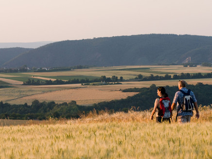
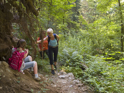
... the interplay of quiet forest sections and scenic passages over the Mosel plateau make the charm of this hike. Jungle-like paths lead through stream valleys to exposed viewpoints at Hitzlay and near the Mönch-Felix-Hütte.
Highlights along the Traumpfad
- Jungle path Schwalberbachtal
- Röder Chapel
- Hitzlay with great panoramic view of the Mosel valley
- Lookout tower "Mönch-Felix-Hütte"
Impressions
General information
Directions
Directly near the Linkemühle in Niederfell, the path gently climbs through the quiet Aspeler Bachtal. Here, the hiker finds themselves in the midst of unspoiled nature: babbling brooks, crookedly grown trees, and rugged rock cliffs inspire daydreaming. A narrow path continues to Schwalberhof. Further on, a magnificent panoramic view of the volcanic cones of the Vordereifel opens up before the hiker dives into the wonderfully quiet Schwalberbachtal. Once crossed, the path leads through extensive fields to the Arkenwälderhof and finally re-enters the majestic beech high forest. The next adventure awaits: crossing the Aspeler Bach via a ford. Shortly after climbing the riverbank, the hiker enters the dreamy Niederfeller Forest. Leaving it behind, a fantastic view over the Mosel plateau unfolds. Past the beautiful Röder Chapel, the path continues to Hitzlay. From this exposed viewpoint, the Mosel valley lies at the hiker’s feet like an enchanted model landscape. Along lush hedges and through orchards, the path slowly heads towards the Mosel valley. Great views and impressive rock cliffs accompany the way to the lookout tower of the Mönch-Felix-Hütte, which offers a legendary view of the Mosel before the trail returns to the destination via the Nachtigallenpfad.
Safety Guidelines
In some sections, surefootedness and a head for heights are required.
General safety instructions:
Safety instructions - safe hiking on the Traumpfade
Hikers desire narrow paths, natural trails (over forest floor, grass paths, or along streams) and rocky ascents leading to spectacular views. It goes without saying that such paths must be walked with special care.
What you should consider on your hike:
- Wear weather-appropriate, suitable clothing that protects you from cold and wet or heat and sun.
- Plan your hike with adequate breaks and conserve your strength.
- Carry sufficient liquids. Refreshment options are not available everywhere.
- Please wear hiking shoes appropriate for the Traumpfad that offer enough support even on slippery and steep or rocky and uneven paths.
- If you believe certain trail sections are impassable for you, you should detour or turn back. Especially in adverse weather, natural paths can become muddy and slippery.
- In autumn, note that fallen leaves can hide unevenness, roots, stones, or holes in the path.
- You must expect such path impairments when hiking.
- Before your hike, check on the internet at https://www.traumpfade.info/traumpfade/wege-status/ whether the Traumpfad you intend to hike is possibly closed, if detours are in place, or if construction work or other disturbances such as logging are planned.
- Recommended hiking months: April to October.
Difficulty classification
Easy routes
... have only minor altitude differences and can mostly be managed in half a day in terms of distance. They pose no special demands on fitness or surefootedness. No sections require a head for heights. Short steeper sections are possible. Depending on the trail format, parts may be difficult to walk in wet weather.
Medium routes
... can be managed well with normal fitness. Path sections may require good surefootedness, so sturdy footwear is important; hiking poles can be useful. Some slightly longer and steeper ascents and descents are possible. Difficult (sometimes secured) passages are the absolute exception and can usually be bypassed. Natural sections can be difficult to walk in wet weather.
Hard routes
... demand very good fitness and endurance due to the length and/or altitude to be covered. Very good surefootedness is required to manage steep ascents and descents on sometimes challenging paths. Rope-secured sections and/or simple climbing passages that require a minimum head for heights are possible. Sturdy footwear and hiking poles are important. Paths and exposed sections are often only difficult or not passable in wet or wintry weather.
Equipment
Sturdy footwear is recommended for the route!
Find trail closures at: https://www.traumpfade.info/traumpfade/wege-status/
Tip
***Attention: Parking lot cannot be driven to - detour to access the hiking trail***
Starting from 18.10.2023, the LBM will carry out repairs on a retaining wall at the Aspeler Bach. This will result in a full closure in the area of Bachstraße.
As a result, the access to the parking lot at Linkemühle (Bachstraße 22) is no longer reachable.
A detour / access to the hiking trail can be made via a path between house numbers Bachstraße 16 & 18.
The total construction period is about 4 months.
Please use the following parking options:
- Shoulder strip B 49
- Parking lot "Unter den Linden" (at Café Sander), portal signs are posted here
- Carpool parking lot, Moselgoldbrücke
Getting there
Along B 49 by the Mosel to Niederfell - (A 61 exit Koblenz/Dieblich continue on B 411 to B 49)
56332 Niederfell, at the Linkemühle (Bachstraße 22)
Parking
56332 Niederfell, parking lot at the Linkemühle (Bachstraße 22)
Public transit
Literature
- Traumpfade & Traumpfädchen Vol. 1: The 18 Best Premium Circular Routes on the Rhine and Mosel, Ulrike Poller & Wolfgang Todt, ISBN: 978-3-942779-64-7
- 27 Premium Circular Routes Traumpfade, Anniversary Edition 10 Years Traumpfade, Ulrike Poller & Wolfgang Todt, ISBN: 978-3-942779-43-2
Maps
- Leisure map Mosel "Maifeld und Untermosel" (1:25 000), ISBN: 978-3-944620-16-9
Additional Information
Tourist Information Sonnige Untermosel, Tel.: 02605/8472736, touristik@sonnige-untermosel.de, www.sonnige-untermosel.de
Project office Traumpfade, Tel.: 0261/108419, info@traumpfade.info, www.traumpfade.info
Traumpfade App
Traumpfade App for iOS: Download app on iTunes
Traumpfade App for Android: Download app on Google Play
Pavings
- Path (44%)
- Asphalt Coating (7%)
- Hiking Trail (50%)
Weather

This tour is presented by: Traumpfade im Rhein-Mosel-Eifel-Land, Author: Nicole Pfeifer


