Saar-Riesling-Steig shortcut
- start: Angelweiher, 54441 Ockfen
- destination: Angelweiher, 54441 Ockfen
- medium
- 8,73 km
- 4 hours
- 388 m
- 379 m
- 168 m
- 60 / 100
- 60 / 100
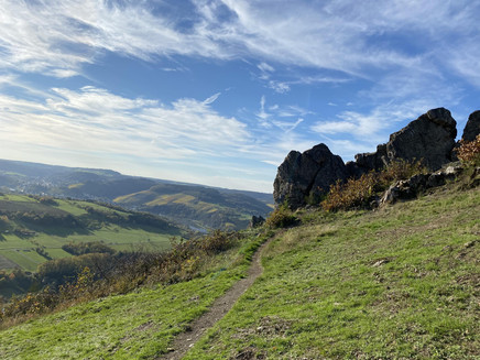
The shortcut via the Moselsteig side trip Saar-Riesling-Steig runs between Schoden and Ockfen. You can expect wonderful views of the Saar valley.
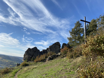
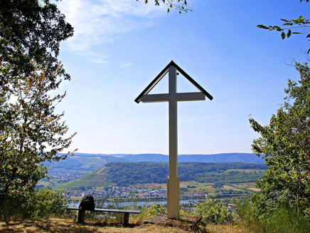
Your hike starts at the Angelweiher in Ockfen. Uphill, the route leads into the vineyards to the first highlight of this route: the Bocksteinfels. It is worth climbing the rock here to enjoy a magnificent view of the Saar valley. Passing the viewpoint Heppenstein, continue hiking to the Bismarckturm in Schoden. Your hike then continues through deciduous and coniferous forest. You should not miss a detour to the Schleidkreuz. Soon you will leave the main route of the Saar-Riesling-Steig and hike back towards Ockfen.
Impressions
General information
Directions
Angelweiher Ockfen - Saar-Riesling-Steig - Vineyards - Bocksteinfels - Saar-Riesling-Steig - Heppenstein - Saar-Riesling-Steig - Bismarckturm Schoden - Saar-Riesling-Steig - Detour Schleidkreuz - Saar-Riesling-Steig - Shortcut back to Ockfen
Safety Guidelines
Please bring enough backpack provisions as there are no dining options along the route. We recommend planning a detour to the villages of Schoden and Ockfen. Please check the opening hours of the restaurants/inns/wine taverns before your hike: https://www.saar-obermosel.de/wein/gastrofuehrer
Please note: the shortcut back to Ockfen is not signposted.
Equipment
Please remember to wear sturdy footwear.
Tip
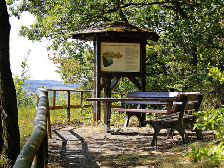
The viewpoints are ideal for taking a break and enjoying the stunning views.
Getting there
From Saarburg, you can reach Ockfen via the L 138.
Parking
There are free parking facilities at the Angelweiher in Ockfen.
Public transit
The Schoden-Ockfen DB train station is located in Schoden and can be reached via the Saarbrücken-Trier rail line.
Information on the bus network can be found at: https://vrt-info.de/busnetz
Literature
The brochure for the Moselsteig side trip Saar-Riesling-Steig is available at the tourist information offices in Konz and Saarburg.
Maps
The brochure for the Moselsteig side trip Saar-Riesling-Steig is available at the tourist information offices in Konz and Saarburg.
Additional Information
Saar-Obermosel-Touristik, Tourist Information Saarburg, Graf-Siegfried-Str. 32, 54439 Saarburg, Tel. 06581-995980
Saar-Obermosel-Touristik, Tourist Information Konz, Saarstr. 1, 54329 Konz, Tel. 06501-6018040
E-mail: info@saar-obermosel.de
Visit our website with exclusive tips and info about the Saar-Obermosel holiday region:
https://www.saar-obermosel.de/
https://www.facebook.com/saarobermosel
https://www.instagram.com/saarobermosel
https://www.youtube.com/channel/UCkcqfebcdiSYLAAj_qIxsBQ
Pavings
- Crushed Rock (22%)
- Hiking Trail (69%)
- Path (9%)
Weather
This tour is presented by: Saar-Obermosel-Touristik e.V , Author: Saar-Obermosel-Touristik e.V.
