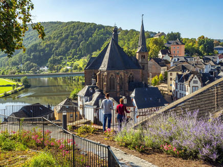
Romantic Route - Access route on the Moselsteig from Palzem to Saarburg
- start: Palzem, town center
- destination: Saarburg, Graf-Siegfried-Strasse
- difficult
- 23,06 km
- 6 hours 30 minutes
- 274 m
- 396 m
- 154 m
- 100 / 100
- 80 / 100
The hike leads from Palzem on the main route of the Moselsteig to Kreuzweiler and further on the access route via Merzkirchen and Trassem to Saarburg.
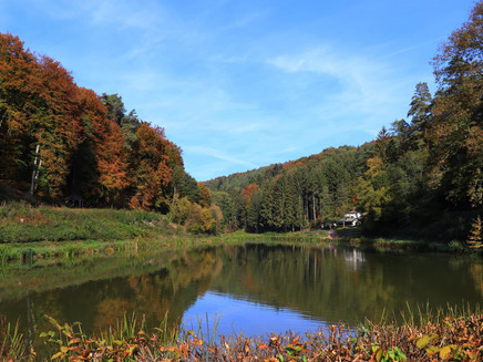
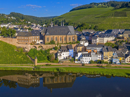
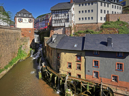
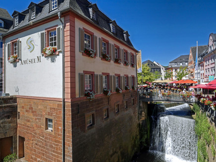
The hike on the Moselsteig access route starts in Palzem on the Upper Moselle. On the main route of the Moselsteig, it first goes to Kreuzweiler. The route continues on the signposted access route towards Merzkirchen, where beautiful panoramic views of the Saargau can be enjoyed. Just before Trassem, the fishing pond is passed. The last stretch of the hike leads through the romantic Leukbachtal to the destination Saarburg. The medieval town offers numerous sights worth visiting!
Impressions
General information
Directions
Palzem - Moselsteig towards Perl – Dilmarbach – Kreuzweiler – Jungenwald – Breisdorferwald – L 133 – here turn onto the access route towards Saarburg – Moschholz – Ehringer Berg – Windpark Kirf – Merzkirchen – Portz – Angelweiher Trassem – Trassem – Perdenbach – Leukbachtal – Saarburg.
Safety Guidelines
Please note that there are no dining options on the route from Palzem to Trassem. Therefore, sufficient backpack provisions are recommended.
Equipment
Sturdy footwear and sufficient backpack provisions are recommended.
Tip
The Moselsteig access routes Palzem - Saarburg and Saarburg - Konz combined with Moselsteig stages 2+3 create a varied 4-day circular route!
Getting there
Palzem is accessible via the B 419 along the Mosel.
Parking
In Palzem there are parking options in the town center around the marketplace.
Public transit
Palzem is accessible via the DB line Wittlich-Trier-Perl. Saarburg can be reached via the DB line Saarbrücken - Trier.
Information on current public transport timetables is available at www.bahn.de or www.vrt-info.de.
Literature
Tips and information as well as free brochures and map material for the Saar-Obermosel holiday region are available from Saar-Obermosel-Touristik at the tourist information offices in Konz (Tel. 06501-6018040) and Saarburg (Tel. 06581-995980).
Or order the desired brochures directly from our online brochure shop.
Maps
The Moselsteig leisure map - Map 1 from Perl to Trier (Stages 1 - 4) at a scale of 1 : 25,000 is available for 5.90 € at Saar-Obermosel-Touristik in the tourist information offices in Konz and Saarburg. Or order the map directly from our online brochure shop.
Additional Information
Saar-Obermosel-Touristik, Tourist Information Saarburg, Graf-Siegfried-Str. 32, 54439 Saarburg, Tel. 06581-995980.
Saar-Obermosel-Touristik, Tourist Information Konz, Saarstr. 1, 54329 Konz, Tel. 06501-6018040.
E-mail: info@saar-obermosel.de
Visit our website with exclusive tips and info about the Saar-Obermosel holiday region:
https://www.saar-obermosel.de/
https://www.facebook.com/saarobermosel
Pavings
- Street (9%)
- Hiking Trail (46%)
- Crushed Rock (33%)
- Asphalt Coating (8%)
- Path (3%)
Weather
This tour is presented by: Saar-Obermosel-Touristik e.V , Author: Saar-Obermosel-Touristik e.V.
