Panorama route around Pluwig
- start: Parking lot at the Pluwig sports field
- destination: Parking lot at the Pluwig sports field
- medium
- 9,37 km
- 2 hours 35 minutes
- 185 m
- 418 m
- 271 m
- 60 / 100
- 60 / 100
Views of the neighboring municipalities & distant views in the upper Ruwer Valley. The route passes by the Pluwig Apothecary Garden, where there are not only medicinal plants to discover.
Above the Ruwer Valley, this approx. 9 km route goes around the municipality of Pluwig. Along the way, you can repeatedly enjoy views and distant vistas of the various neighboring municipalities. The Pluwig Apothecary Garden is also a highlight along the path. Besides the medicinal plants and herbs, there is much to admire and learn in the nature and paradise garden. A registered visit is worthwhile!
We recommend the sports field in Pluwig as a starting point for our short hike, where you will find free parking spaces in sufficient numbers. From here, any other route around Pluwig can be started.
The route is signposted in one direction.
Impressions
General information
Directions
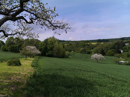
Right at the beginning, there is the first panoramic view of the municipality of Pluwig.
At the start, we stay on the outer edge of the village within the built-up area. Passing the entrance to the festival grounds, another view opens up – this time over the Ruwer Valley to Lonzenburg and on the opposite side to Gusterath.
Following the road, the 3 Pluwig hiking trails meet and accompany each other for a while. At the edge of the village, we begin our ascent up the heights through the new development area. After leaving the last houses behind, we are soon rewarded at the "Oberhausener Kreuz" crossroads with a bench from which there is a nice view over the localities of Pluwig and Gusterath and a short stretch further on towards Schöndorf and Holzerath.
The next opportunity to recover from the ascent follows just a few meters away at the "Fliegerkreuz". From here, panoramic views open up during the further course of our hike over the localities of Pellingen – Gusterath – Lonzenburg – Holzerath – Schöndorf – Hinzenburg – Geizenburg – Ollmuth – Pluwig.
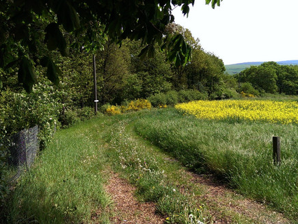
Here we encounter the "Karl-May-Wanderweg" again, which will accompany us for a stretch over the heights. Past meadows, pastures, and fields, we reach the "Geertskreuz" and shortly afterward a junction where a path leads back to the center of Pluwig. Here the "Karl-May-Wanderweg" leaves us again. We continue hiking over the heights and reach the main road at the overview map. Shortly after crossing the main road, another crossroads with a bench invites us to pause again before we tackle the last ascent of our hike. Upon reaching the highest point of our panorama hike, our path leads downhill along the main road back toward the Pluwig locality – sheltered by a "hedgerow".
After crossing the main road, we now approach the "Pluwig Apothecary Garden." By the way: After prior appointment, the Sänger family gladly invites you to linger here. Besides information about garden seminars and group tours, Mr. Sänger also has tips about other beautiful hiking routes nearby.
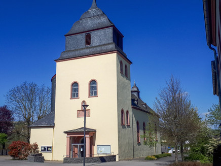
After leaving the Hurkelbach village area, the path leads us a little along the main road and past a section of our local fruit producer back into the village of Pluwig. The return path to the parking lot now leads us over the church square and past the multi-generation playground.
Safety Guidelines
Entering the forest and walking the hiking trails is generally at your own risk. Depending on the season and weather, increased surefootedness is required on certain trail sections. Therefore, wear clothing and hiking shoes with appropriate tread suited to the season and weather conditions.
Equipment
Sturdy footwear, comfortable and weather-appropriate clothing, provisions recommended.
Tip
Plan a visit to the Pluwig Apothecary Garden!
Getting there
via L 139 and K 57
Navigation destination input: 54316 Pluwig, Kreuzgarten 17
Parking
Parking available at the Pluwig sports field
Public transit
City bus lines 30 and 86
More info at: www.vrt-info.de
Additional Information
All about the Apothecary Garden and contact details for prior appointment at http://apothekergarten-pluwig.de/
Pavings
- Crushed Rock (44%)
- Hiking Trail (24%)
- Path (8%)
- Asphalt Coating (18%)
- Street (6%)
- Unknown (1%)
Weather

This tour is presented by: Mosel. Faszination Urlaub, Author: Touristinformation Ruwer


