Orchid paradise Wasserliesch
- start: Marketplace/Station Wasserliesch
- destination: Marketplace/Station Wasserliesch
- easy
- 7,03 km
- 1 hour 45 minutes
- 277 m
- 341 m
- 137 m
- 80 / 100
- 20 / 100
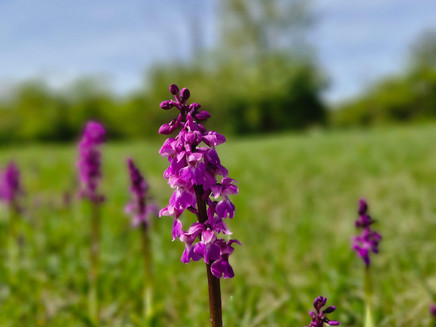
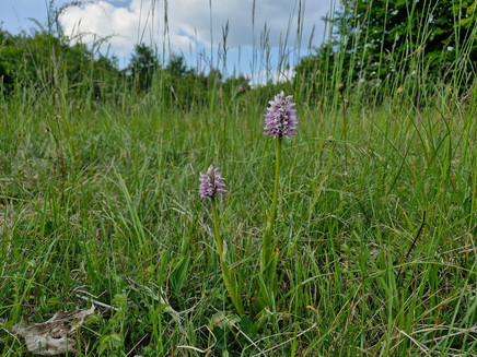
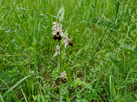
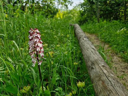
The lady orchid, helleborine, yellow gentian, and lady’s slipper are the undisputed stars of the small circular hike from Wasserliesch to Liescher Berg.
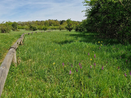
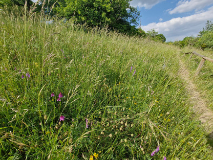
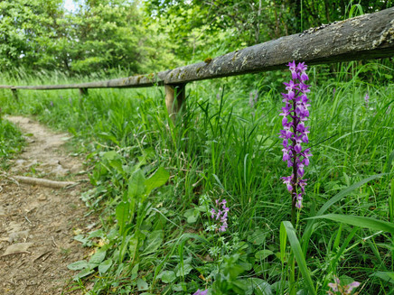
On the plateau of Löschemer Berg in Wasserliesch lies the nature reserve "Perfeist" with a unique vegetation. Due to favorable climate and soil conditions, a variety of now rare and protected plant and animal species have settled here, especially orchids. With 28 species, ranging from marsh orchids to helleborines to yellow gentian, the area is one of the most important orchid habitats in Germany.
Impressions
General information
Directions
Those arriving by train will start this botanical hike at the station. Everyone else will start at the nearby marketplace in Wasserliesch. At the station, go under the tracks and follow the street "Heidegarten" uphill until it becomes the Station Path, accompanied by field crosses, leading to the edge of the forest. Here the hiking trails split. The Station Path continues straight uphill, while the theme path first takes a detour to the grenade monument. Then slightly downhill, you walk through a magnificent mixed forest until a signpost indicates the side path to the monument. Those who want to go there, also for the view of the Moselle valley, must expect some height loss.
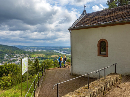
Back at the signpost, the route now begins to rise noticeably again. A forest road leads steeply through dense woods up to the plateau of Liescher Berg. At the top, do not go straight ahead but at a sharp angle right along the edge of the mountain toward the Löschemer Chapel. This is the ideal place to watch the ships on the Moselle while resting and to let time pass by. You could sit here forever!
Walking between meadows and pine forest, it is not far to the orchid trail in the nature reserve "Perfeist". An information board at the small hiking car park provides information about the orchid paradise, and warning signs clearly emphasize the need to "stay on the path." This is important because nature here is extremely sensitive. A narrow meadow path runs as a circular route through the calcareous magnesian grassland area, which is one of the most important refuges for rare orchids in Germany. Small nameplates show which plants can be seen. 28 orchid species, from marsh orchids through helleborines, louseworts, pyramid orchids, tongue orchids to bird’s nest orchids are along the path and provide magnificent photo opportunities. The visual stars, however, are the splendid lady’s slippers, which belong to the lily family. The yellow gentian is also not to be missed. The return path to Wasserliesch follows the asphalt access road leading straight downhill from the hiking car park. Views of beautiful meadow orchards, and sometimes also of the town of Igel, sweeten the descent.
Equipment
Good to walk in sturdy sneakers. Bring provisions or stop in Wasserliesch.
Tip
Bring binoculars, as some orchids do not stand right on the path. Possibly carry a guidebook (e.g., "Orchids of Europe," Ulmer Verlag or Kosmos Nature Guide "What’s Blooming There?") or participate in a guided hike.
Getting there
Wasserliesch is reachable via the B419.
Parking
We recommend the free parking lot behind St. Aper Church (Hauptstr. 58-60, 54332 Wasserliesch). From there, the starting point at the marketplace is reachable on foot in 2 minutes. Another parking option is available at the marketplace (only a few spaces available here).
Also, the hiking car park on Löschemer Berg can be reached via Löschemer Straße.
Public transit
We recommend arriving by train. Wasserliesch is accessible via the Wittlich-Trier-Perl railway line. The starting point at the marketplace is located very close to the Wasserliesch station.
Information about current public transport schedules can be found at www.bahn.de or www.vrt-info.de.
Literature
The free leisure map for the Saar-Obermosel holiday region is available from Saar-Obermosel-Touristik at the tourist information offices in Konz (Tel. 06501-6018040) and Saarburg (Tel. 06581-995980).
Or order the map directly from our online brochure shop.
Maps
The hiking map "Holiday Region Saar-Obermosel" at a scale of 1:35,000 is available for €8.95 at the tourist information offices in Konz and Saarburg. Or order the map directly from our online brochure shop.
Additional Information
Saar-Obermosel-Touristik, Tourist Information Saarburg, Graf-Siegfried-Str. 32, 54439 Saarburg, Tel. 06581-995980
Saar-Obermosel-Touristik, Tourist Information Konz, Saarstr. 1, 54329 Konz, Tel. 06501-6018040
Email: info@saar-obermosel.de
Visit our website with exclusive tips and info about the holiday region Saar-Obermosel:
https://www.saar-obermosel.de/
https://www.facebook.com/saarobermosel
https://www.instagram.com/saarobermosel
https://www.youtube.com/@saarobermosel4183
Weather

This tour is presented by: Saar-Obermosel-Touristik e.V , Author: Saar-Obermosel-Touristik e.V.
