Moselsteig Trail Stage 20: Treis-Karden – Moselkern
- start: Treis-Karden: Karden, St.-Castor-Straße directly adjacent to the railway station
- destination: Moselkern: Railway station at the edge of the town
- medium
- 13,58 km
- 4 hours 30 minutes
- 527 m
- 285 m
- 75 m
- 80 / 100
- 40 / 100
From cathedrals to castles.
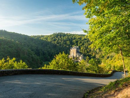
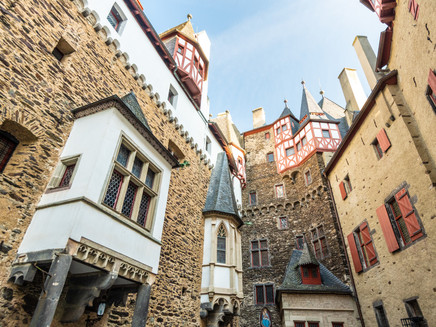
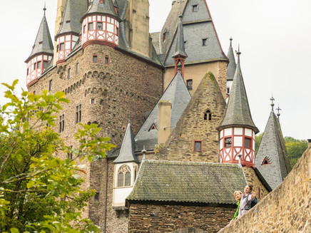
This section of the trail starts with culture and history: passing the Moselle Cathedral – the Monastery Church to St. Castor in Treis-Karden – the trail then leads up a short but steep path into the open countryside, unique because of its wild box shrubs. There now follow some quite challenging sections along the edge of the slope and across steep vineyards looking over to the Wild Gorge of the Krailsbach stream. The high point of this section for hikers is undoubtedly Eltz Castle – one of the landmarks of German history. It lies hidden in the Elzbach Valley and thus was saved from the destruction of the Thirty Years War and the Palatinate War of Succession. It is definitely worth making a short detour to visit the castle, which still has its original furnishings, with a treasure and armoury chamber richly stocked with jewellery, weapons and porcelain. After this interesting stop-off, continue along the Elzbach stream to your final destination for the day in Moselkern.
Impressions
General information
Directions
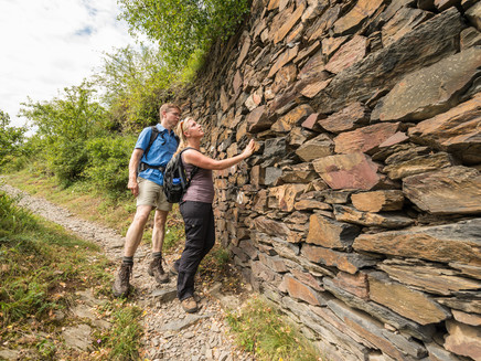
You start this beautiful stage towards Moselkern a few steps next to the railway station of Treis-Karden in the St. Castor Straße. In the village you will soon arrive at the St. Castor Basilica, whose outline shapes Treis-Karden. When you have crossed the Kernstraße and the Brohlbach, which flows into the Moselle here, you reach the outskirts of the town. The Moselsteig Trail, together with the Buchsbaum Trail now both take you uphill. Old vineyard walls line the path. Take time to look around when ascending, and have a look at Treis-Karden and St. Castor – it's worth it! In a narrow side valley, high boxwood shrubs come close to the path, before the path reaches the slope edge. From here, the view of the valley is even better! You continue uphill on a rocky ridge, and finally reach the mountain hut at the Kompeskopf.
Now a short flat section through the forest follows, but the Moselsteig Trail soon runs downhill again. You reach the forest gorge of the Krailsbach, which is densely populated with boxwood the further downhill you go. Also the path becomes more rocky and increasingly spectacular. Your safety is ensured: When descending over rocks and steps you can hold on to ropes. You cross the Krailsbach and are back in the actual Moselle Valley. The path now alternates uphill and downhill and thick boxwood shrubs alternate with free views of the valley. Finally, you reach the vineyard path which will bring you closer to Müden on an even section. The access route branches off at a rest area above the village. It takes you into the village and in the Moselle Valley it continues to Moselkern.
The Moselsteig Trail takes another detour to Burg Eltz (Castle Eltz) before it reaches the river again in Moselkern. You now hike up the steep mountain again. The path first take you through low woods and then enters a deciduous forest. Cross stations accompany your climb. At the slope edge you also reach the edge of the forest, and the path now slightly ascends up to the few houses of Müdenerberg. You reach a chapel, where the cross path ends. First next to, and then for a short distance on a road, which does not see a lot of traffic, the Moselsteig Trail takes you across the open plateau. The long descent into the Etz Valley starts at the edge of the forest, and passes the Forsthaus Rotherhof. Following the forest path you make quick headway at a moderate incline. Where the trail narrows down to a path, just a few metres further, there is a quiet rest area with view of Burg Eltz (Castle Eltz). Wouldn't this be the perfect place for a delicious picnic? A beautiful spot in the middle of the forest, within sight of the castle, with its romantic location in the green Etztal?
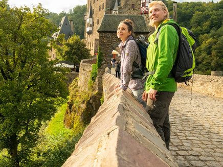
The descent continues over a ridge, which drops steeply on both sides to the Elzbach Valley. Once you have arrived at the bottom, you cross the Elzbach over an old stone bridge. From here, the Moselsteig Trail takes you along the same route as the Dream Path Eltzer Burgpanorama (Castle Eltz Panorama). Along the stream, you continue to the "Fünfhundert-Mark-Blick" (Five Hundred Marks View). The beautiful view of Burg Eltz (Castle Eltz) used to adorn the back of the 500 German Mark note. Soon, the stone bridge to the castle is reached, and if you would like to enjoy some medieval flair, you should definitely take time for a tour.
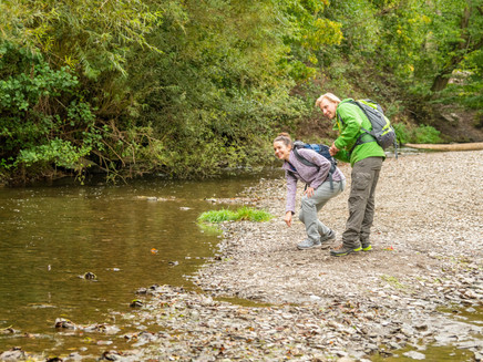
Thereafter, you continue over the Moselkern Steps to a footbridge, which again takes you to the other side of the Elzbach. The path now alternates from higher and lower heights across the Elzbach. Shortly before the Ringelsteiner Mill, the creak level is finally reached and you come to the mill on a paved track – a great place for your last stop for refreshments. The remaining section at the end of the stage is a pleasant hike. Cross the Elzbach one more time, and the Dream Path and Moselsteig Trail turn off here. But the Moselsteig Trail access route which continues to Moselkern, runs along the stream. First, you hike on a path on the narrow valley floor, later along the access road to the Ringelsteiner Mill through Moselkern. After the underpass, you will reach the first vineyards. One more section and you have reached the end of this stage: the Moselkern railway station.
Equipment
- Sturdy hiking footwear
- Appropriate weatherproof hiking gear
- Picnic lunch
Getting there
Starting point: Treis-Karden via the B 49 or B 416
Destination: Moselkern via the B 416 between Treis-Karden and Koblenz
Parking
Treis-Karden: There is a car park close to the railway station.
Moselkern: Parking at the railway station; large car park at the junction of Kirchstraße and Moselstraße
Public transit
You can reach the stage towns Treis-Karden (train station) as well as Moselkern (train station) by train (RB 81).
There are regular connections. Please note that during the school vacations of Rhineland-Palatinate / Saarland, at weekends and on public holidays there may be restrictions on the frequency! Please refer to the timetable information on the website of the Verkehrsverbund Rhein-Mosel (VRM): www.vrminfo.de
Literature
"Moselsteig" - Offzieller Moselsteig-Wanderführer von ideemedia, 14,95 €
Authors: Ulrike Poller, Wolfgang Todt, publisher: ideemedia, 300 pages with around 300 images, altitude profiles, QR codes and GPS Tracks (in German), Format 11,5 x 23 cm, ISBN: 978-3-942779-21-0, 14,95 €
"Official Moselsteig Trail hiking maps" in pocket format:
The entire route is divided into 3 maps:
Leisure Map Moselsteig - Map 1: Perl - Trier (Stages 1 - 4), ISBN: 978-3-89637-419-6
Leisure Map Moselsteig - Map 2: Trier – Zell (Moselle) (Stages 5 -14), ISBN: 978-3-89637-420-2 Leisure Map Moselsteig - Map 3: Zell (Moselle) – Koblenz (Stages 15 -24) ISBN: 978-3-89637-421-9
Individual maps: €5.90
Set of 3 maps: € 14.50 (ISBN: 978-3-89637422-6)
"Premium-Set"
Premium set consisting of the official hiking guide including set of 3 hiking maps. Publisher: ideemedia, ISBN: 978-3-942779-24-1, 26,95 €
The hiking guides and the maps are available in bookstores or on the website https://www.visitmosel.de/wandern/service-infos-tipps under the heading “Ordering brochures”.
Maps
Leisure Map Moselsteig Trail – Map 3: Zell (Moselle) - Koblenz (Stages 15 - 24), ISBN: 978-3-89637-421-9
Additional Information
Mosellandtouristik GmbH
Kordelweg 1, 54470 Bernkastel-Kues; Phone: +49 (0)6531 / 97330
Tourist information office Treis-Karden
St.-Castor-Straße 87, 56253 Treis-Karden, OT Karden; Phone: +49 (0)2672 / 9157700
Tourist information office Maifeld
Münsterplatz 6, 56294 Münstermaifeld, Phone: +49 (0)2605 / 9615026
Weather

This tour is presented by: Mosel. Faszination Urlaub, Author: Mosellandtouristik GmbH
