Moselsteig Side Trail Moselachter
- start: parking space Zummethöhe, 54340 Leiwen-Zummet, Panoramaweg 1-3
- destination: parking space Zummethöhe, 54340 Leiwen-Zummet, Panoramaweg 1-3
- medium
- 14,41 km
- 5 hours
- 400 m
- 370 m
- 210 m
- 80 / 100
- 60 / 100
Hiking by numbers.
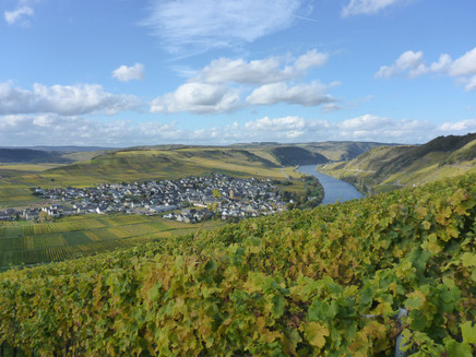
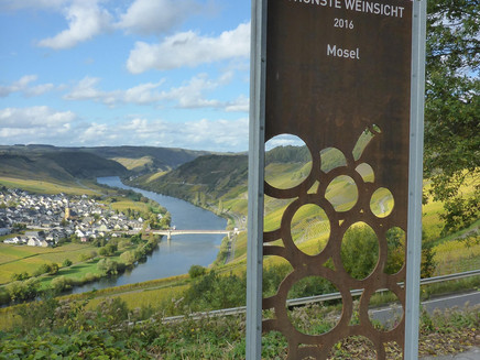
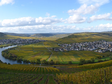
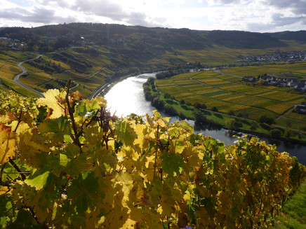
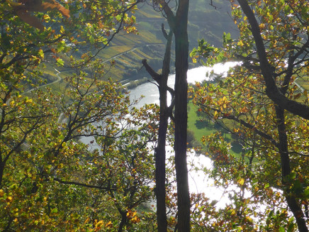
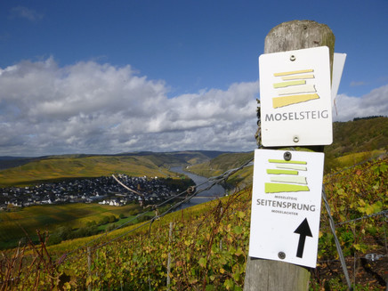
Two varied circular paths which meet at one of the most famous and beautiful viewpoints on the Moselle, the Zummethöhe, creating a trail in the shape of a figure of eight. The Moselachter (The Moselle Figure of Eight) offers everything a hiking enthusiast would expect from a Moselle trail. The Kronenberg circular (downstream direction) and the Sonnenberg circular (upstream direction) which meet at the Zummethöhe carpark, come together to form a 15 km-long trail. The Moselachter starts and ends with a Moselle picture book view, which was awarded the title of the Moselle wine-growing region’s “Most Beautiful Wine Viewpoint 2016” in an open online vote by the German Wine Institute. From the view of the Moselle loop near Trittenheim the trail continues up to Konstantinhöhe. Hikers wonder across the Kronenberg plateau and the region stretching towards the valley of the Little Dhron on the return leg of the Kronenberg circular. The Leiwen Sonnenberg (Sunshine Mountain) with holiday park, climbing wall, animal enclosure and panoramic views is the highlight of the second loop of the Moselachter trail. There are refreshment and rest stops well spread out across the entire route.
Impressions
General information
Directions
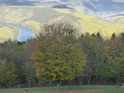
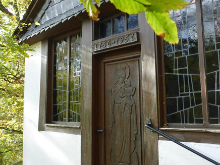
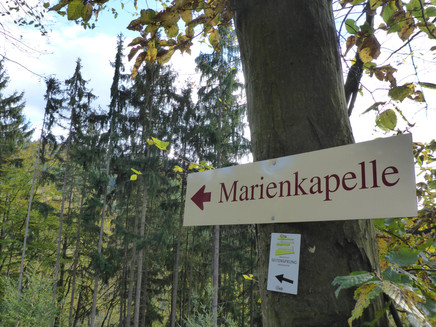
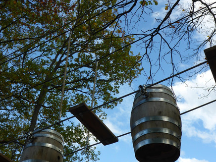
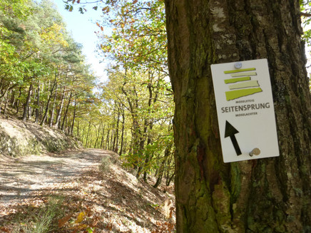
The side trail starts at the Zummethöhe carpark. The approx. 15 km-long route is a figure of eight split up into two circular routes of roughly the same size (Kronenberg circular upstream and Sonnenberg circular downstream) which intersect at the starting point, the Zummethöhe carpark. This means you can decide after finishing one of the two circular routes whether you would like to finish there or add on the second part of the figure of eight. The Kronenberg circular is dominated by vineyards and open landscape, while the Sonnenberg circular leads through forest for a large part of the route. Both circular routes offer an abundance of panoramic views. The Kronenberg circular starts on the side of the street opposite the carpark. From here you can enjoy a panoramic view of the Moselle loop from Trittenheim and Leiwen. This view accompanies the hiker throughout the entirety of this flat route through vineyards. This is a good opportunity to warm up before the trail leads onto the steep slope. If you are not very surefooted, use the recommended alternative route that joins back up with the main route again at Konstantinhöhe. The path through the steep tree-covered slope is gradually undulating before it finally climbs sharply past a shale cave (take a torch with you) to the Konstantinhöhe. With its beautiful rest stop, the plateau is a great place to take a break. Moving on from the Konstantinhöhe, the route moves slightly away from the Moselle valley and leads along meadow paths lined by hedges on a moderately steep ascent up to the Kronenberg plateau. Those arriving on the plateau (primarily used as a large connected grazing land for the Kron farm) will be met with almost unobstructed views in all directions. While the edge of the slope towards the Moselle offers an impressive view downwards onto the river, here it is the distant view of the peaks of the Eifel and Hunsrück mountain ranges that offers the wow-factor. Upon looping around the plateau, the side trail leads right past Kron farm estate, a great place for a refreshment stop. A short section of the side trail follows the access road to the farm, before the circular route leads down a steep meadow path to a path on the slope above the valley of the Little Dhron. The rest of the path winds along the slope. The south-facing slopes of the Moselle tributary valley used to be covered with vineyards. Now only a few parcels of land are used for growing and there is a hotchpotch of vineyards , open space, the beginnings of reforestation and fallow land. Underneath a barbecue hut you will come across the Moselsteig trail, which joins the side trail all the way back to the Zummethöhe carpark. Looking down into the valley of the Little Dhron from the path on the slope, you can see a few mills too. One of these mills was the birthplace of the famous author Stefan Andres whose novels tell stories of his childhood in a secluded spot on the Moselle (“Der Knabe im Brunnen”). After familiarising hikers with the landscape east of the Zummethöhe in the first part of the Moselachter, the Sonnenberg circular starts on the same side as hikers’ carpark and leads the trailblazers around the Sonnenberg holiday park perched on the summit. Before starting, hungry and thirsty hikers can pause for refreshments on the Zummethöhe (a terrace with great views is available too). Initially, the trail runs together with Moselsteig on a tarmacked path up a moderately steep hill to a large forest crossroads. The next part of the trail (now guided solely by the side trail signposting) follows a slightly uphill forest path. Impressive Douglas firs line the path to the left and the right. At the edge of the Sonnenberg holiday park on the summit is a climbing park those who still want to do some “real climbing” after the ascent. The holiday park offers a whole host of options to break up the hike (restaurants, minigolf etc.). The side trail leads through the holiday houses to the most southerly point of the Moselachter. The subsequent forest path through mixed woodland winds along the Schantelbach valley slope facing the Moselle without any great change in height. After a hairpin bend, the scene changes and the trail encounters an orchard. The many seats and benches at the upper edge of the meadow are aptly referred to as the “Moselkino” or Moselle Cinema. Hikers can lie out in the terrace-like meadow plateau and enjoy the Moselle panorama out towards Leiwen and Trittenheim. It’s a place people struggle to tear themselves away from. Now the trail moves on to a slightly steeper ascent. The last part of the climb (together with Moselsteig) leads past a wild animal enclosure. Right at the top, hikers can recharge at a rest stop or on a lounger and enjoy another slightly different view of the Moselle loop. The Moselachter leads down into the forest with the Moselsteig. Follow and cross the access road to the holiday park until you come to the large forest crossroads seen on the way out. A small detour will take you to the Lady Chapel nestled into the slate rocks on the Little Dhron valley slope. The forest path above the road then leads quickly back to the car park at Zummethöhe.
Safety Guidelines
One section of the Kronenberg circular should only be attempted by surefooted hikers. Hikers will see signposts to an easier alternative trail at the relevant part of the route.
Equipment
The Side Trail should only be hiked on with suitable (sturdy) shoes/hiking boots.
Tip
The first section of the Moselachter (the Kronenberg circular) is dominated by vineyards and open landscapes. This is something to bear in mind on sunny days. The Sonnenberg circular is suitable for hiking on warm and sunny days because it leads through large sections of forest. The views are plentiful on both loops. Picnic spots include Konstantinhöhe, the “Moselkino” (Moselle Cinema) or the rest stops above the animal enclosure.
Getting there
Take the B 53 to Trittenheim town centre and then take the L 148 to Leiwen-Zummet.
Parking
The Zummethöhe hikers’ carpark has about twenty parking spaces. At the carpark you will find an information board for the trail. You can join either of the circular sections here.
Public transit
Through the Moselle Valley between Trier and Bullay, the bus route 333 operated by Moselbahn follows the Moselle river passing Ruwer, Schweich, Mehring, Leiwen, Trittenheim, Neumagen, Bernkastel-Kues and Traben. For timetable information visit: www.moselbahn.de/de/fahrplaene_strecken/fahrplaene
or go directly to the timetable page of the VRT and enter bus route 333 in the form: https://www.moselbahn.de/de/fahrplaene_strecken/linie/333
Literature
Literature (only available in German):
"Seitensprünge" Band 1 - 10 Premium-Rundwanderungen von Trier bis Bernkastel-Kues von ideemedia
Authors: Ulrike Poller, Wolfgang Todt, Publisher: ideemedia, 114 pages, Format: 11,0 x 16,4 cm, ISBN: 978-3-942779-59-3, 12,95 €
Maps
Moselle hiking map - Schweich holiday region on the Roman Wine Route, 1:25.000 ISBN: 978-3-944620-13-8, price: €7.90
The map is available in bookstores, from the Moselle region tourism association and the Roman Wine Route tourist information office.
Additional Information
Mosellandtouristik GmbH
Kordelweg 1, 54470 Bernkastel-Kues; Phone: +49 (6531) 97330
Tourist information office Römische Weinstraße
Brückenstr. 46, 54338 Schweich; Phone: +49 (6502) 93380
Pavings
- Asphalt Coating (9%)
- Hiking Trail (66%)
- Path (8%)
- Crushed Rock (18%)
Weather
This tour is presented by: Verein Römische Weinstraße e.V., Author: Mosellandtouristik GmbH
