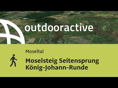
Moselsteig side route König-Johann-Runde
- start: Old town wall in the town center, 54450 Freudenburg
- destination: Old town wall in the town center, 54450 Freudenburg
- medium
- 11,85 km
- 4 hours
- 320 m
- 440 m
- 210 m
- 100 / 100
- 60 / 100
On the trail of the blue-blooded lords of the castle.
The premium hiking trail connects the historic castle complex in the town center of Freudenburg with varied landscapes, many viewpoints, sandstone rocks, and the nature reserve "Eiderberg." The namesake of the 12-kilometer-long hiking trail is King John the Blind of Bohemia, Count of Luxembourg, who built a castle complex in Freudenburg in the 14th century. The start and end point of this varied hike is the old town wall in the historic town center of Freudenburg. From there, the path leads through a varied landscape with many viewpoints and panoramas reaching as far as Luxembourg and France. Other highlights on the trail are the castle complex that towers on a mighty sandstone rock and the Leukbach valley with several small cascading “waterfalls” and historic mills. In the “Kollesleuker Switzerland,” colorful Buntsandstein rocks rise steeply in varied shapes and colors. Nature lovers can enjoy rare orchids on the 440-meter-high “Eiderberg,” which is under nature protection.
Impressions


General information
Directions
The König-Johann-Runde starts at Weiherplatz in Freudenburg. The starting point of the hike is located at the restored town wall with a fountain and seating facilities. After a short stairway downhill, you immediately find yourself on a path section amid untouched nature. The path leads, always slightly downhill and uphill, past the rock face on which the houses of the old town center of Freudenburg stand. At the ruins of Freudenburg Castle, the hiking trail runs through the castle moat to a rest bench, where you can enjoy the first view of the Leuk valley. Continue on the path to the castle peak, then downhill, you reach the valley at the Freudenburg stream. Here at the new pedestrian bridge, a table-bench group invites you to rest.
The next section of the path leads level through the Herrenwald forest to the barbecue hut, where a break is offered on covered benches. After crossing Gartenstraße, the detour leads back into the forest. After a sharp turn to the right, the route runs past the Wenigbach, which has deeply cut its bed into the rocks in this area. The beautiful path passage is only interrupted by the bridge over the Ewigbach. Just behind the bridge, a panoramic view opens over the Leuk valley to the heights of the Saargau. Here at the rest bench, a path section begins on which the most diverse forest formations are passed through.
The streambed on the left forms the state border to Saarland here. Initially level, then downhill, the detour leads down into the Leukbach valley. From the forest edge, you have a beautiful view of the impressive building of the lower Stegmühle. After crossing the road, past the shelter, the route runs through the romantic Leukbach valley. At the stone bridge, you should not miss a detour into the wild and romantic Ewigbach valley. Here the little stream ends after about 200 m in an impressive rock backdrop. Continuing gently downhill, on the left the floodplains of the Leuk, on the right the rock formations of the Buntsandstein, the view opens at the mushroom rock to Kollesleuken. Through the meadow valley at the Herrenmühle over the Leuk, you reach the left bank of the stream. At the Herrenmühle, a visit to the Wildling sales and pickup station is worthwhile. Here you can try special products made from apple, pear & Co. Wildling products include Kellvados aged in whisky barrels, apple and pear schnapps, fine fruit brandies, pear secco, jellies & jams, apple vinegar aged in wooden barrels, and other selected products from partners of the regional initiative "Ebbes von Hei!". Opening hours can be found at www.wildling-von-hei.de.
The path section leads slightly uphill and downhill through beech forest and past rock formations. Footbridges have been erected at various points between the mill pond of the Hackenberger mill and the rock walls. At the newly designed mill square in Kollesleuken, the decision to take a break will certainly be easy for you.
The further path leads past the forest edge with beautiful views into the meadow valley of the Leuk. Now follows the first ascent of the path. Initially still over a forest road, then on a path uphill to the forest area "Klingerheck." After a steady ascent through tall beech forest, another path section begins before you leave the forest and can enjoy the view at a rest area. Below the Eiderberg, you reach the L131. The road should be crossed with extreme caution.
Initially past the edge of a hedge, with a magnificent panorama towards the Saargau, it now becomes really steep again. Here you are already in the Eiderberg nature reserve. On this section of the path, you can admire rare plants in early summer. The highest point of the Eiderberg is also the highest point of the hike on the König-Johann-Runde. From here you can enjoy a panorama that is probably unique. Views open into Saarland, the Saargau, and over the Saar to the Osburger Hochwald. Still in the nature reserve, the path leads past former quarries, now downhill to the village of Freudenburg. Past the Jewish cemetery and along the Kelterplatz, it is only a few meters to the starting point at Weiherplatz.
Equipment
Please make sure to wear sturdy footwear and bring enough backpack supplies.
Tip
Don't miss a detour into the Ewigbach valley!
Also visit the Wildling sales and pickup station, which is located directly on the hiking trail, and try special products made from apple, pear & Co.
Opening hours: www.wildling-von-hei.de
Getting there
The B 407 leads from Saarburg to Trassem. Then continue on the country road towards Freudenburg.
Parking
Free parking is available in the town center of Freudenburg.
Public transit
You can reach the town of Saarburg by train on the Saarbrücken-Trier railway line. From there, bus lines 241 and 248 regularly run to Freudenburg. There is no bus service on Sundays.
Information on current public transport schedules is available at www.bahn.de or www.vrt-info.de.
Literature
"Moselsteig Side Routes 1 – The most beautiful circular routes between Trier and Bernkastel-Kues" by ideemedia
Authors: Ulrike Poller, Wolfgang Todt, Publisher: ideemedia, 144 pages, format: 11.0 x 16.4 cm, ISBN: 978-3-942779-59-3, €12.95
Maps
The hiking map "Holiday Region Saar-Upper Moselle" at a scale of 1:35,000 is available for €8.95 at the tourist information offices in Konz and Saarburg.
Or order the map directly in our online brochure shop.
Additional Information
Saar-Obermosel-Touristik e. V.
Saarstr. 1, 54329 Konz, Tel. 06501-6018040
Graf-Siegfried-Str. 32, 54439 Saarburg, Tel. 06581-995980,
https://www.facebook.com/saarobermosel
https://www.instagram.com/saarobermosel
https://www.youtube.com/channel/UCkcqfebcdiSYLAAj_qIxsBQ
Mosellandtouristik GmbH
Kordelweg 1, 54470 Bernkastel-Kues, Tel. 06531-97330
Pavings
- Path (52%)
- Hiking Trail (21%)
- Asphalt Coating (9%)
- Crushed Rock (16%)
- Street (2%)
Weather


This tour is presented by: Saar-Obermosel-Touristik e.V , Author: Saar-Obermosel-Touristik e.V.