Family-friendly hiking route Marienburg in the Zeller Land
- start: Reil station
- destination: Bullay station
- easy
- 7,95 km
- 3 hours 30 minutes
- 210 m
- 240 m
- 90 m
- 80 / 100
- 20 / 100
On this section of the Moselsteig, the highlights follow in close succession, connected by a varied path. And the outbound or return trip by train is uniquely beautiful.
Impressions
General information
Directions
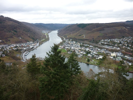
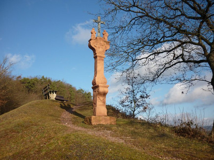
The path towards Bullay starts at the Reil station on Kaiserstraße. For the first meters, our family route and the Moselsteig run along the same track as the Kanonenbahnweg, across the station grounds into a quiet residential street. This leads you to the outskirts of town and, after crossing the tracks, through the vineyards uphill. Stations of the Way of the Cross accompany the path. On the saddle of the Reiler Hals, the path then reaches a chapel and a wayside cross at the parking lot. Benches invite you to take a short break after the climb. The view back to Reil is worth it! Downriver, you can already see the viewing tower on the Prinzenkopf and the Marienburg. These destinations are later on the path.
Now the path goes steeply uphill through the forest to a hilltop, where the forest opens the view towards the Alfbach valley. Then the path leads downhill again and on a wider path, the Moselsteig now heads without major elevation changes through the varied high forest towards the Leo rocks, a few steps off the main path. From the pavilion on the rock, you have a beautiful view towards the Mosel and Alf. In the other direction, you can see further into the Alftal valley with its steep, forest-covered hills. One of them crowns the Arras castle, to which a side path leads from here. The path through the high forest reaches the Drieschhütte at the forest edge. Surrounded by many seating options, this is one of the most beautiful views of the Marienburg. When the hut is staffed in summer, you might not want to leave this spot.
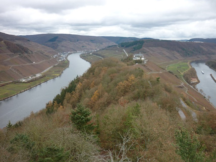
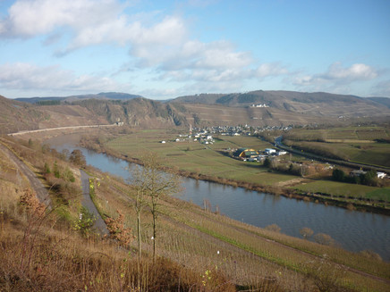
But the path offers even better views, which will not keep you waiting long. The Ehrenfriedhof cemetery is quickly reached on the ridge path. The further path then leads steeply uphill to the Prinzenkopf viewing tower. You should not miss climbing it, as the view from up here is truly breathtaking! The two arms of the Zeller Mosel loop are so close together that you can see the Mosel multiple times. The view extends over Reil, Pünderich, Briedel to Bullay, Alf, St. Aldegund, and Neef. And towards Zell, the Marienburg towers on the saddle planted with vines. The view from up here is so beautiful that it is no surprise that the iron tower is not the first at this spot. It also had wooden predecessors.
A scenic path then leads to the Marienburg and subsequently on a path on the backside of the complex. To get to Bullay station, follow the Moselsteig connecting path now. The path winds slowly downhill along the forest slope. At the double bridge over the Mosel, you reach the B 53, which should be crossed carefully.
Via the sidewalk next to the road, you reach the other Mosel side on the "lower level", while above, the trains cross the river (first double-deck bridge in Germany).
The station or parking lot as the destination is now quickly reached.
Tip
If you travel by car, leave your car at Bullay station and take the train to the starting point in Reil before the hike.
Advantage: There are plenty of parking spaces available at Bullay station, and you can return to the car relaxed and without time pressure by hiking back.
During the season, there is the possibility to stop for refreshments at the Drieschhütte, right in the middle of nature.
Getting there
Reil station is easily accessible by train.
The station is located directly on the L 105 in the center of Reil.
Parking
Bullay station
There are some parking spaces available for hikers at Reil station.
Public transit
Bullay station is located on the Mosel route between Trier and Koblenz. Both regional train and regional express stop here.
Reil station is a stop on the Moselweinbahn, which runs between Bullay and Traben-Trarbach.
Weather

This tour is presented by: Mosel. Faszination Urlaub, Author: Mosellandtouristik GmbH


