Collis steep path Zell (Mosel)
- start: Market square, "Zeller Schwarze Katz" fountain, D-56856 Zell (Mosel)
- destination: Market square, "Zeller Schwarze Katz" fountain, D-56856 Zell (Mosel)
- medium
- 2,58 km
- 1 hour 15 minutes
- 280 m
- 261 m
- 101 m
- 100 / 100
- 40 / 100
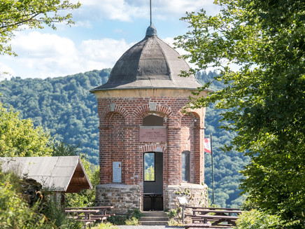
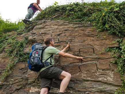
Up via stirrups and ladders to the Collis Tower.
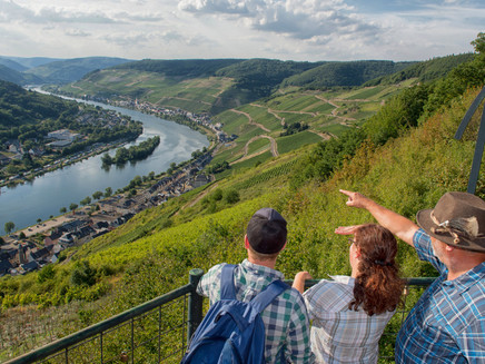
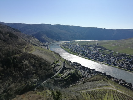
The „Collis steep path“ with via ferratas, 160 meters of elevation and a length of 1.2 kilometers has an alpine character and is perfectly secured with stirrups, ladders and wire ropes thanks to the Alpine Club Koblenz and the local heritage and tourist association Zell (Mosel). Those who do not want to climb can bypass the via ferrata on the steep path along old vineyard walls.
Impressions
General information
Directions
Starting point: „Zeller Schwarze Katz“ fountain - uphill following Marktstraße towards Cuxborn - Zeller Kehr – past the square tower to the fork in the path - turn left into Kabertchenweg - after about 20 meters enter the via ferrata, which can be bypassed via the „Collis steep path“ - at Rommeneyweg keep right - after about 150 meters you reach the entrance to the second section - at the end of the steep path you reach the Collis Tower.
Safety Guidelines
Via ferrata requires surefootedness and a head for heights.
Equipment
Sturdy footwear
Tip
For those who have not had enough of Zellerland, you can continue along the "Collis circular hiking trail" through the vineyards. At the viewpoint "Löhnshöhe" you finally reach the viewpoint "Löhnshöhe", from where you can start your return to Zell (Mosel).
Getting there
Across the B53 to the opposite side of the Moselle (via the double-deck bridge Bullay or the car bridge in Zell-Kaimt). Then keep straight ahead until the town hall / tourist information.
Balduinstr. 44
D-56856 Zell (Mosel)
Parking
Parking spaces along the Moselle riverbank at Zell (Mosel) (paid).
Free parking spaces on "Brandenburg" and "Zum Bahnhof" streets.
Public transit
By train to Bullay and from there continue with lines 720, 721 or 750 to Zell (Mosel) Lindenplatz. Further information at: https://www.vrminfo.de/fahrplanauskunft/.
Maps
Hiking map Zellerland
ISBN 978-3-944620-12-1
Available at Zeller Land Tourismus GmbH, Balduinstr. 44, D-56856 Zell (Mosel), Tel. +49 6542 9622-0, info@zellerland.de, www.zellerland.de
Additional Information
Refreshment opportunity Collis Tower, May - October, Saturdays and Sundays from 11 am to 5 pm, additionally open when the blue flag is flying.
Zeller Land Tourismus GmbH
Balduinstr. 44
D-56856 Zell (Mosel)
Tel. +49 6542 9622-0
info@zellerland.de
www.zellerland.de
Pavings
- Asphalt Coating (42%)
- Crushed Rock (2%)
- Path (50%)
- Hiking Trail (5%)
Weather
This tour is presented by: Zeller Land Tourismus GmbH
