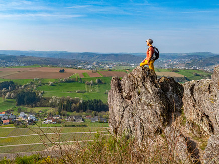
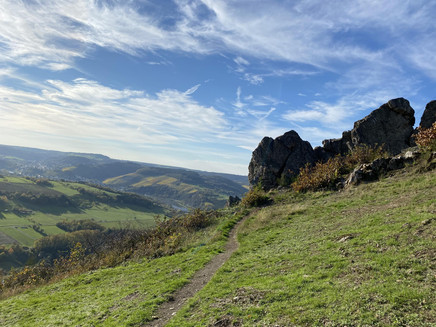
Circular hike "Kaselbach via Irsch to the Ockfen pond"
- start: Wine Hotel Klostermühle Ockfen
- destination: Wine Hotel Klostermühle Ockfen
- medium
- 8,61 km
- 3 hours
- 71 m
- 209 m
- 140 m
- 60 / 100
- 40 / 100
Varied circular hike with Saar river promenade, vineyards, meadows, and pond area.
At the beginning of this hike, walk along the cycle path towards Saarburg. After about 800 meters, turn left through the small bridge and immediately left again. Shortly after, a small path appears that you continue to stroll along. You must go under the next small bridge and then hike up the small incline on the right to the upper Kaselmühle. The second path on the right is the G5 hiking trail, which you continue to follow towards Irsch. Continuing along the G5, you reach the wine village of Irsch. Soon you leave this path and follow the bike and traffic signs towards Ockfen. For a short distance, you now walk along the road. After a few meters, the cycle and footpath to Ockfen branches off to the left. Passing the meadows where hang gliders land, you come to the pond area. If you now go left, you will soon reach the first houses of Ockfen. Walk back along the main road to your starting point.
Impressions
General information
Directions
At the beginning of this hike, walk along the cycle path towards Saarburg. After about 800 meters, turn left through the small bridge and immediately left again, leaving the lower Kaselmühle on your right. Shortly after, a small path appears that you continue to stroll along. You must go under the next small bridge and then hike up the small incline on the right. You will now see the upper Kaselmühle below the vineyards. The mills are named after the Kaselbach stream. The second path on the right is the G5 hiking trail, which you continue to follow towards Irsch. Continuing along the G5, you reach the wine village of Irsch. Soon you leave this path and follow the bike and traffic signs towards Ockfen. For a short distance, you now walk along the road. After a few meters, the cycle and footpath to Ockfen branches off to the left. Passing the meadows where hang gliders land, you come to the pond of the Ockfen Angling Club. If you now go left, you will soon reach the first houses of Ockfen. Now you can continue walking along the main road or, if your condition allows, take a small detour through the vineyards. Take one of the paths branching off to the right. Simply continue downwards to automatically reach your starting point.
Please note that this hiking trail is not a certified premium trail and there is no continuous signage for the route. Furthermore, part of the path runs on paved farm roads and not on narrow trails.
Equipment
Please remember to wear sturdy footwear and bring sufficient backpack provisions.
Tip
Plan a break at the idyllic Ockfen pond area.
Getting there
From Saarburg, drive on L 138 to Ockfen.
Parking
Free parking is available at the parking lot on L 138.
Public transit
Information on current bus schedules is available at: www.vrt-info.de/busnetz
Literature
Maps for the Saar-Upper Moselle holiday region are available at the Saarburg and Konz tourist information offices.
Maps
Maps for the Saar-Upper Moselle holiday region are available at the Saarburg and Konz tourist information offices.
Additional Information
Saar-Upper Moselle Tourism, Saarburg Tourist Information, Graf-Siegfried-Str. 32, 54439 Saarburg, Tel. 06581-995980
Saar-Upper Moselle Tourism, Konz Tourist Information, Saarstr. 1, 54329 Konz, Tel. 06501-6018040
Email: info@saar-obermosel.de
Visit our website with exclusive tips and information about the Saar-Upper Moselle holiday region:
https://www.saar-obermosel.de/
https://www.facebook.com/saarobermosel
https://www.instagram.com/saarobermosel
https://www.youtube.com/channel/UCkcqfebcdiSYLAAj_qIxsBQ
Pavings
- Crushed Rock (57%)
- Street (12%)
- Hiking Trail (20%)
- Asphalt Coating (11%)
Weather

This tour is presented by: Saar-Obermosel-Touristik e.V , Author: Saar-Obermosel-Touristik e.V.


