Äppelkist & Schiefer - circular hiking trail in Riveris
- start: Hikers' car park at the Riveris dam
- destination: Hikers' car park at the Riveris dam
- medium
- 7,57 km
- 2 hours 24 minutes
- 323 m
- 356 m
- 187 m
- 80 / 100
- 60 / 100
The apple and slate have always played an important role in Riveris. In order to bring this cultural heritage to life, a circular hiking trail around the village of Riveris was created in 2022.
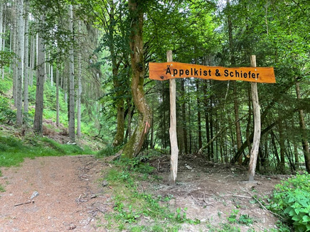
The 7.6 km long circular hiking trail is dedicated to the topics of "Äppelkist & Schiefer", which have a long tradition in the local community of Riveris, at various stations.
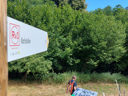
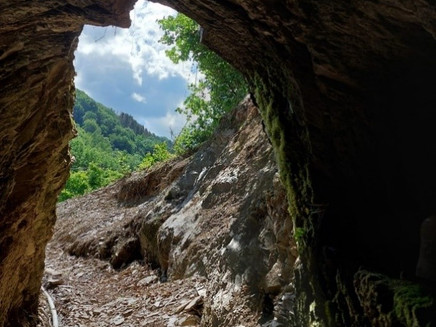
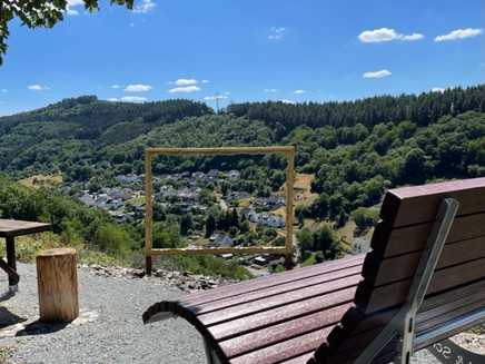
In 2022, with a lot of voluntary commitment from the citizens of Riveris and with the support of the Saar-Hunsrück Nature Park from state funds, this hiking trail was created with highlights such as a slate tunnel that can be experienced, an XXL self-lounging frame, a 360-degree rotating sensory bench and much more. The trail is marked in both directions and can be shortened through the village. The shortcut is signposted at two points along the trail.
The hike can be combined with the Talsperren circular trail from the hikers' car park, in which case the trail distance is approx. 14.5 km.
Impressions
General information
Directions
The trail is signposted in both directions. If you first leave the path in the direction of the village, you pass the "Schlangenpeedschie" coming from the hikers' car park - a rather narrow, but scenically very beautiful stretch along the Riveris and continue hiking along the orchard meadows towards the village.
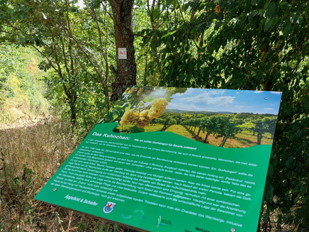
Here you also come across the information board on the subject of meadow orchards and have the option of taking a detour into the village or the designated shortcut through the local community.
The trail continues through the forest until it passes through the village after about 1.5 km and after 2.2 km you reach the mine information point. Here you will find interesting information about "Riveris and the slate". A few metres further on is the Karlstollen, which was made experiencable again in the course of creating the circular trail.
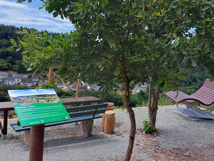
At kilometre 2.8, the trail turns right across the Riveris towards the Bausbachtal valley and then leads steadily uphill to the Panoramablick station. From here, you have a beautiful view of the local community of Riveris and find a nice place to rest and have a picnic.
The trail continues mostly along shady forest paths in the direction of Burgkopf. At kilometre 5.2, there is another opportunity to shorten the route in the direction of the village at a crossroads.
Further through the forest, there are two more information points on the topics of "Forest" and "Forest in Danger" until you head downhill again towards the treading pool near the Riveris. After the hike, you can cool your feet in the pool or in the Riveris. A small bridge leads directly back to the starting point at the hikers' car park.
Safety Guidelines
In principle, entering the forest and walking on the hiking trails is at your own risk.
Depending on the season and the weather, increased surefootedness is required on some sections of the trail. Therefore, wear clothing appropriate to the season and the weather and hiking boots with an appropriate tread.
Equipment
Sturdy shoes, comfortable clothing suitable for the weather, provisions recommended.
Tip
The rotating sensory bench at the Panoramablick rest area invites you to breathe in and relax!
Getting there
From L151 between Trier and Hermeskeil, exit Thomm towards Waldrach and then continue to Riveris. Coming from Trier via Waldrach to Riveris.
Parking
Free parking is available at the hikers' car park.
Public transit
The local community of Riveris can be reached by line 30 of the VRT Trier. Further information at www.vrt-info.de
Pavings
- Hiking Trail (69%)
- Crushed Rock (10%)
- Path (12%)
- Asphalt Coating (5%)
- Unknown (3%)
Weather

This tour is presented by: Mosel. Faszination Urlaub, Author: Touristinformation Ruwer
