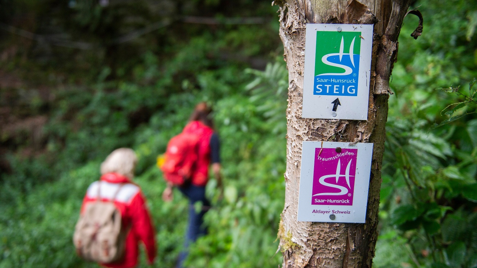
Altlayer Schweiz Dream Loop (Traumschleife)
- start: Altlay
- destination: Altlay
- medium
- 8,67 km
- 3 hours
- 326 m
- 407 m
- 213 m
- 80 / 100
- 60 / 100
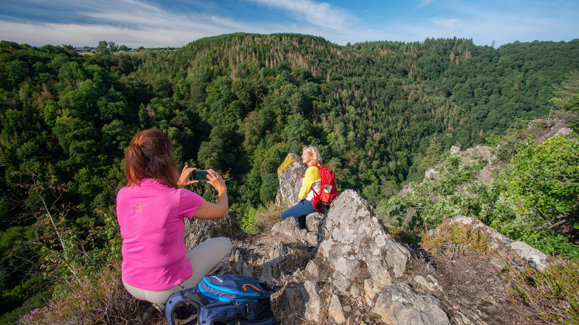
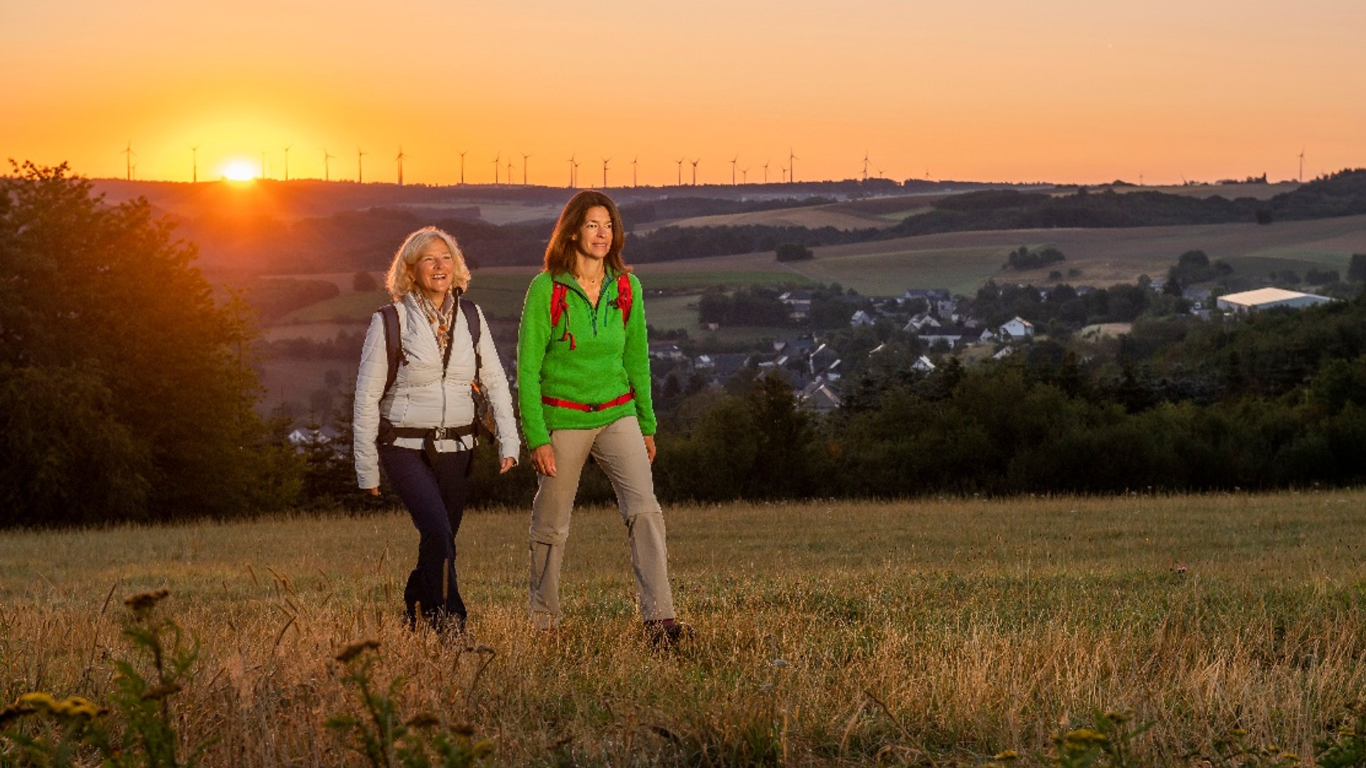
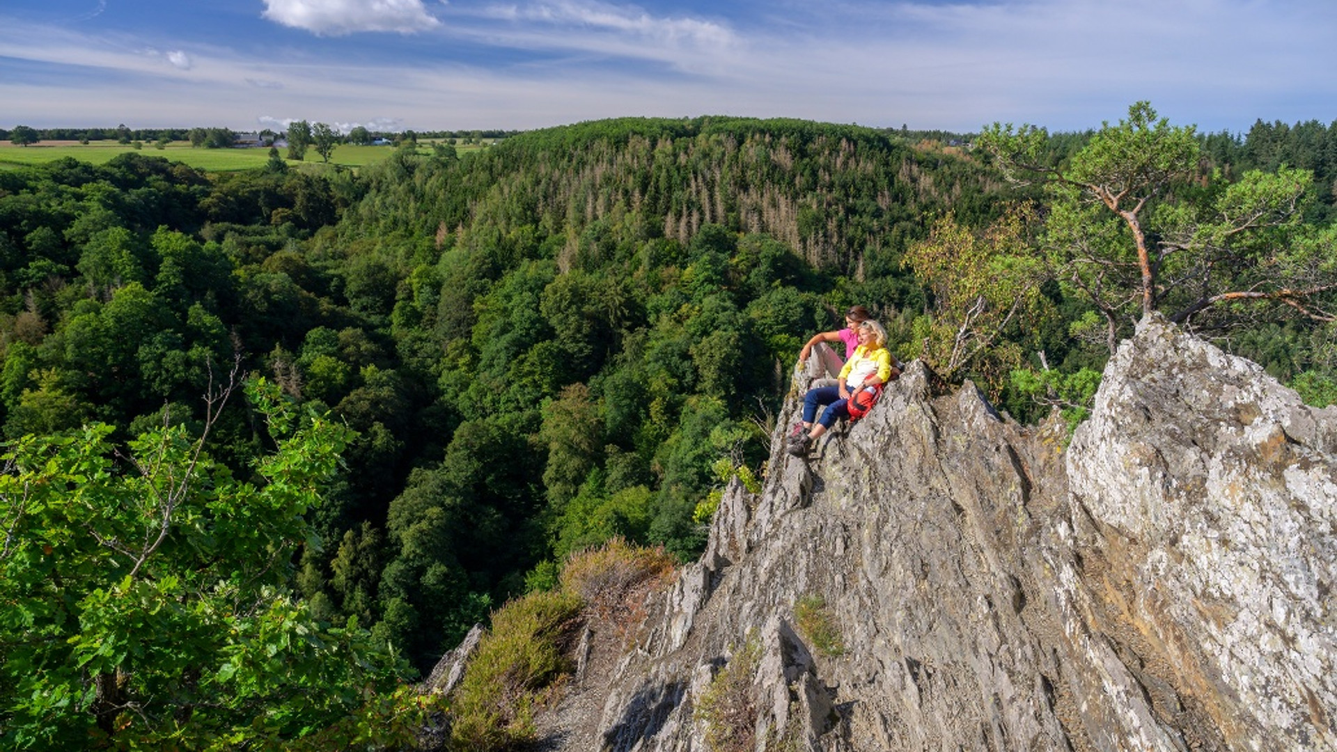
The „Altlayer Schweiz“ trail is characterised by sharp-edged, rugged slate rocks, impressive rock passages, and serpentine forest paths. Idyllic, seemingly untouched stream valleys and extraordinary distant views are further special features of a half-day tour through extensive forest areas of the Hunsrück around Altlay.
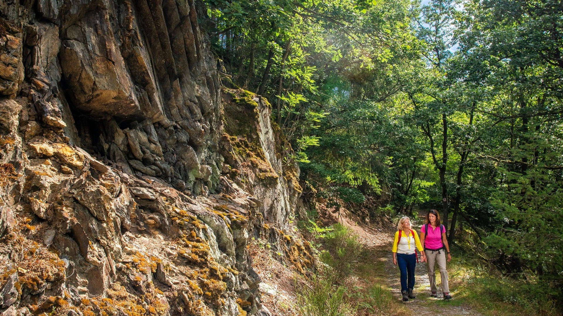
Past craggy, sharp-edged rocks, some of which are covered with mosses, ferns and lichens, a narrow forest path leads far above the Morschbach valley into the middle of the „Altlayer Schweiz“.
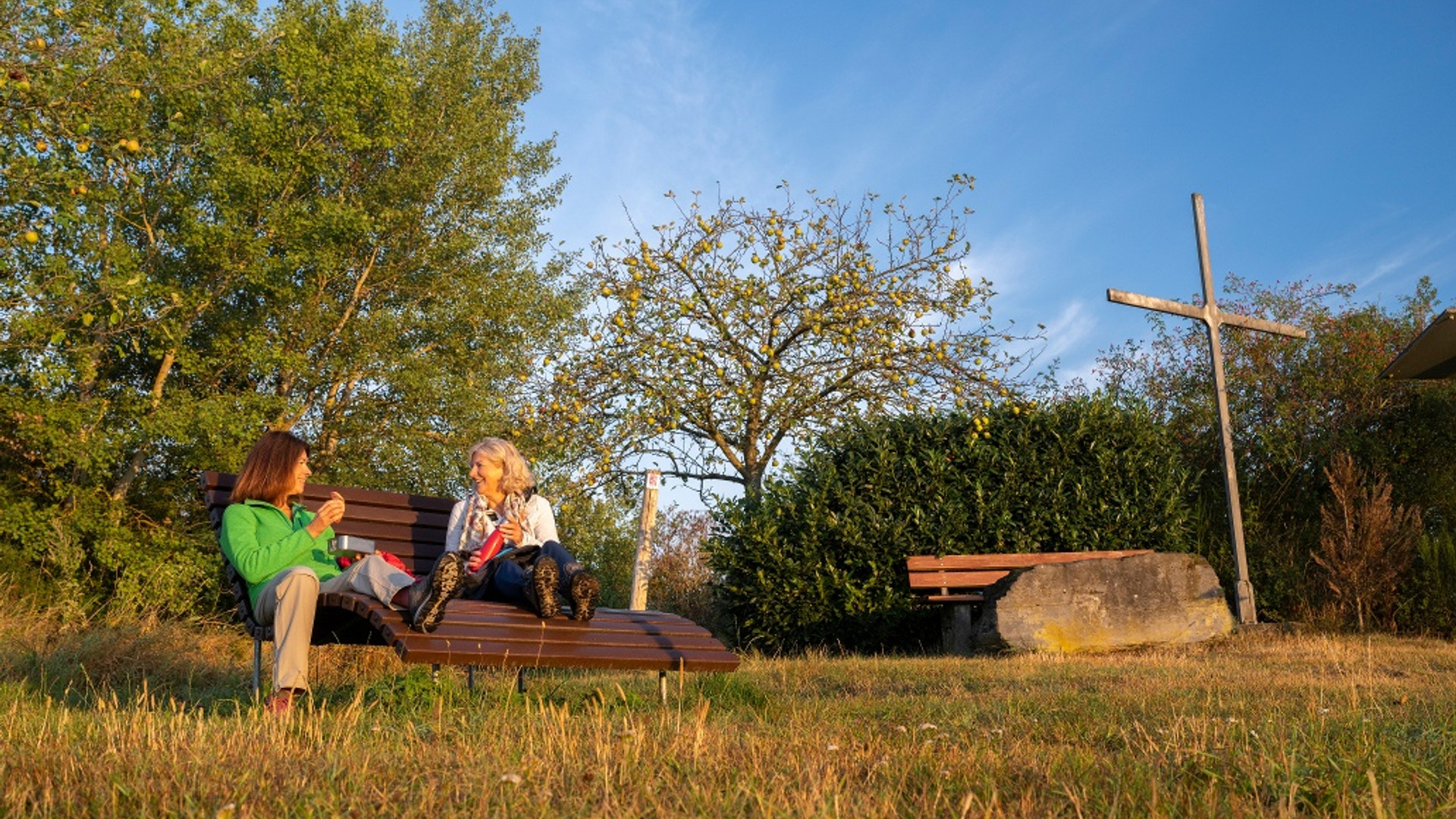
Afterwards, a steep, serpentine section of the path leads along huge slate rocks into the valley. Just before you reach the Hitzelbach stream at the bottom of the valley, there is a roofed forest hut, an ideal place to rest. In the deep, dark valley of the Hitzelbach, the hiker is accompanied only by the rippling of the water. The path winds between the watercourse and deadwood through the humid forest idyll.
Later, before the road connecting Altlay with Zell has to be crossed, the path leads over a rocky surface and a via ferrata secured with steel ropes. On the grounds of the former Altlay sports field, there has been a paintball playground since 2015.
An impressive view is offered a few metres behind the sports grounds at the Stahlkreuz vantage point: opposite on the Hunsrück heights are the villages of Tellig, Schauren, Wahlhauen, Panzweiler, Peterswald-Löffelscheid, Rödelhausen and Würrich; down in the valley, close enough to touch, is Altlay. The entire panorama is framed by the Hunsrück forest towering over everything.
The trail has been certified by the German Hiking Institute with 82 experience points.
Impressions


General information
Directions
After starting at the Altlay portal, the trail first leads us along an old grassy farm track. This is followed by the passage that gives the trail its name. A narrow path leads us over and through the rocky passages of Altlay Switzerland. The rocky ridges offer breathtaking views into and over the deeply cut Hitzelbach valley. The bizarre crown and trunk shapes of the oaks on the slate rocks create a special atmosphere. The first part of the following descent requires surefootedness and can be quite slippery in wet weather. The hikers' hut in the middle of the descent invites you to take a rest before the trail continues in a wide loop downhill into the Hitzelbach valley.
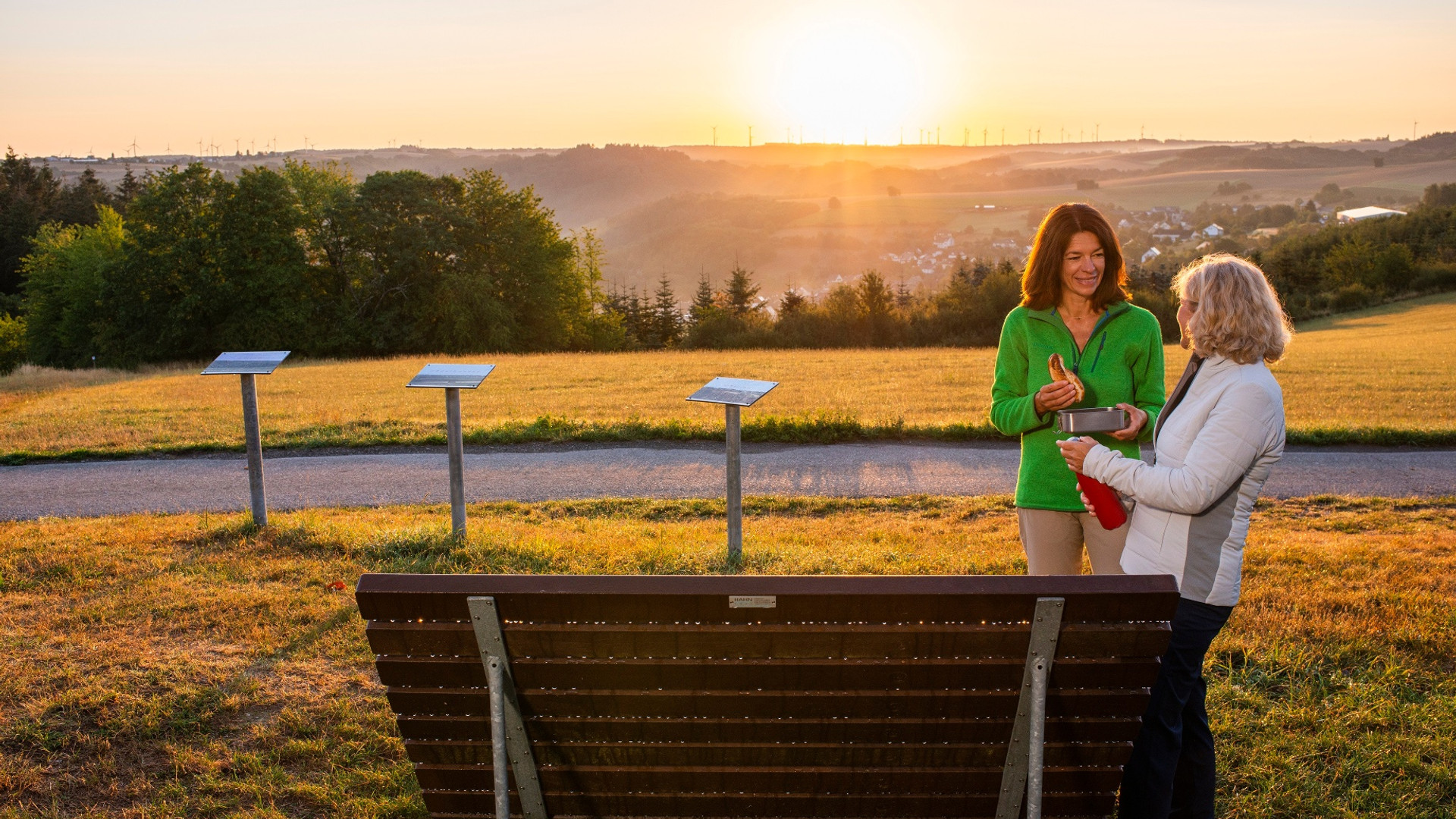
In the valley, the trail leads along a narrow path right next to the water - this part of the trail is romantic and enchanted. We then hike along a field path to the Altlayer Bachtal. There is a very short rope-secured climbing section to reach an old forest path. The trail leads steadily uphill, sometimes as a path, then again as a trail through the open deciduous forest. Information boards along the way provide information on cultural history. At the highest point of the trail, just under 400 m above sea level, we are once again offered a magnificent view. We can enjoy the wide panoramic view over the open field from the wave lounger. The hike ends with a varied passage that first leads along the forest's edge, then along a forest path and finally along a narrow trail back to the starting point. The hut offers another excellent opportunity for a rest. You can continue your hike along the signposted access paths to one of the restaurants in the village.
Safety Guidelines
All of the Traumschleifen have some steep, difficult and, in rainy or winter weather, slippery sections. Therefore, sure-footedness and good physical condition are essential prerequisites for hiking these premium circular trails.
Equipment
Suitable footwear (hiking boots) is strongly recommended.
Tip
The rocky passages of Altlayer Schweiz are the highlights of the dream loop.
Public transit
Line 723 between Bullay and Altlay
Literature
Free of charge:
Brochure "Erlebnis Traumschleifen" with route sketches, altitude profiles, short descriptions and tips on where to stop for refreshments on all 114 dream loops.
Information and request at www.saar-hunsrueck-steig.de/prospekte
Paid travel guides and books in the shop at www.saar-hunsrueck-steig.de
Additional Information
Zeller Land Tourist Board GmbH, Balduinstraße 44, 56856 Zell (Mosel)
Tel. +49 6542 96220, www.zellerland.de
Hunsrück-Touristik GmbH, Gebäude 663, 55483 Hahn-Flughafen
Tel. +49 6543 507700, www.hunsruecktouristik.de
Weather


This tour is presented by: Hunsrück-Touristik GmbH, Author: Iris Müller